You are here: Home > Network List > CI - Caltech Regional Seismic Network Stations List
> Station TIN Tinemaha, Big Pine, CA, USA > Earthquake Result Viewer
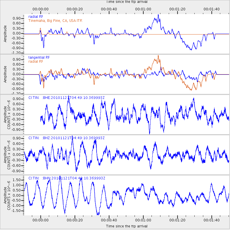
TIN Tinemaha, Big Pine, CA, USA - Earthquake Result Viewer
*The percent match for this event was below the threshold and hence no stack was calculated.
| Earthquake location: |
Pacific-Antarctic Ridge |
| Earthquake latitude/longitude: |
-55.0/-131.5 |
| Earthquake time(UTC): |
2010/11/21 (325) 04:36:31 GMT |
| Earthquake Depth: |
10 km |
| Earthquake Magnitude: |
5.7 MB, 5.8 MS, 6.0 MW, 5.9 MW |
| Earthquake Catalog/Contributor: |
WHDF/NEIC |
|
| Network: |
CI Caltech Regional Seismic Network |
| Station: |
TIN Tinemaha, Big Pine, CA, USA |
| Lat/Lon: |
37.05 N/118.23 W |
| Elevation: |
1197 m |
|
| Distance: |
92.4 deg |
| Az: |
10.574 deg |
| Baz: |
187.601 deg |
| Ray Param: |
$rayparam |
*The percent match for this event was below the threshold and hence was not used in the summary stack. |
|
| Radial Match: |
43.070187 % |
| Radial Bump: |
400 |
| Transverse Match: |
49.04491 % |
| Transverse Bump: |
400 |
| SOD ConfigId: |
343951 |
| Insert Time: |
2011-05-23 21:15:02.382 +0000 |
| GWidth: |
2.5 |
| Max Bumps: |
400 |
| Tol: |
0.001 |
|
Signal To Noise
| Channel | StoN | STA | LTA |
| CI:TIN: :BHZ:20101121T04:49:10.369993Z | 1.40476 | 3.1554973E-7 | 2.246289E-7 |
| CI:TIN: :BHN:20101121T04:49:10.369993Z | 1.4401712 | 9.140353E-7 | 6.3467127E-7 |
| CI:TIN: :BHE:20101121T04:49:10.369993Z | 0.86924845 | 3.4135653E-7 | 3.9270304E-7 |
| Arrivals |
| Ps | |
| PpPs | |
| PsPs/PpSs | |


