You are here: Home > Network List > TA - USArray Transportable Network (new EarthScope stations) Stations List
> Station 533A Kerrville, TX, USA > Earthquake Result Viewer
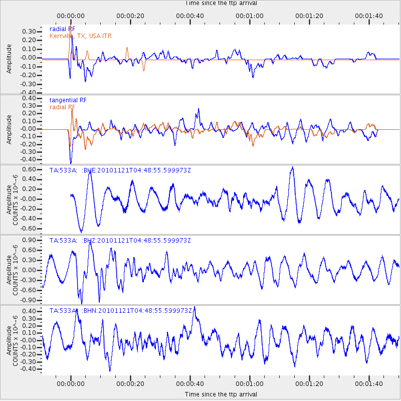
533A Kerrville, TX, USA - Earthquake Result Viewer
*The percent match for this event was below the threshold and hence no stack was calculated.
| Earthquake location: |
Pacific-Antarctic Ridge |
| Earthquake latitude/longitude: |
-55.0/-131.5 |
| Earthquake time(UTC): |
2010/11/21 (325) 04:36:31 GMT |
| Earthquake Depth: |
10 km |
| Earthquake Magnitude: |
5.7 MB, 5.8 MS, 6.0 MW, 5.9 MW |
| Earthquake Catalog/Contributor: |
WHDF/NEIC |
|
| Network: |
TA USArray Transportable Network (new EarthScope stations) |
| Station: |
533A Kerrville, TX, USA |
| Lat/Lon: |
30.07 N/99.04 W |
| Elevation: |
556 m |
|
| Distance: |
89.2 deg |
| Az: |
27.716 deg |
| Baz: |
198.022 deg |
| Ray Param: |
$rayparam |
*The percent match for this event was below the threshold and hence was not used in the summary stack. |
|
| Radial Match: |
43.946247 % |
| Radial Bump: |
400 |
| Transverse Match: |
56.469482 % |
| Transverse Bump: |
400 |
| SOD ConfigId: |
343951 |
| Insert Time: |
2011-05-23 21:26:45.967 +0000 |
| GWidth: |
2.5 |
| Max Bumps: |
400 |
| Tol: |
0.001 |
|
Signal To Noise
| Channel | StoN | STA | LTA |
| TA:533A: :BHZ:20101121T04:48:55.599973Z | 2.3547873 | 5.202374E-7 | 2.2092756E-7 |
| TA:533A: :BHN:20101121T04:48:55.599973Z | 1.5243459 | 2.49442E-7 | 1.6363872E-7 |
| TA:533A: :BHE:20101121T04:48:55.599973Z | 0.66070485 | 1.8528313E-7 | 2.8043254E-7 |
| Arrivals |
| Ps | |
| PpPs | |
| PsPs/PpSs | |


