You are here: Home > Network List > TA - USArray Transportable Network (new EarthScope stations) Stations List
> Station O02D Mt. Diablo Meridian, CA, USA > Earthquake Result Viewer
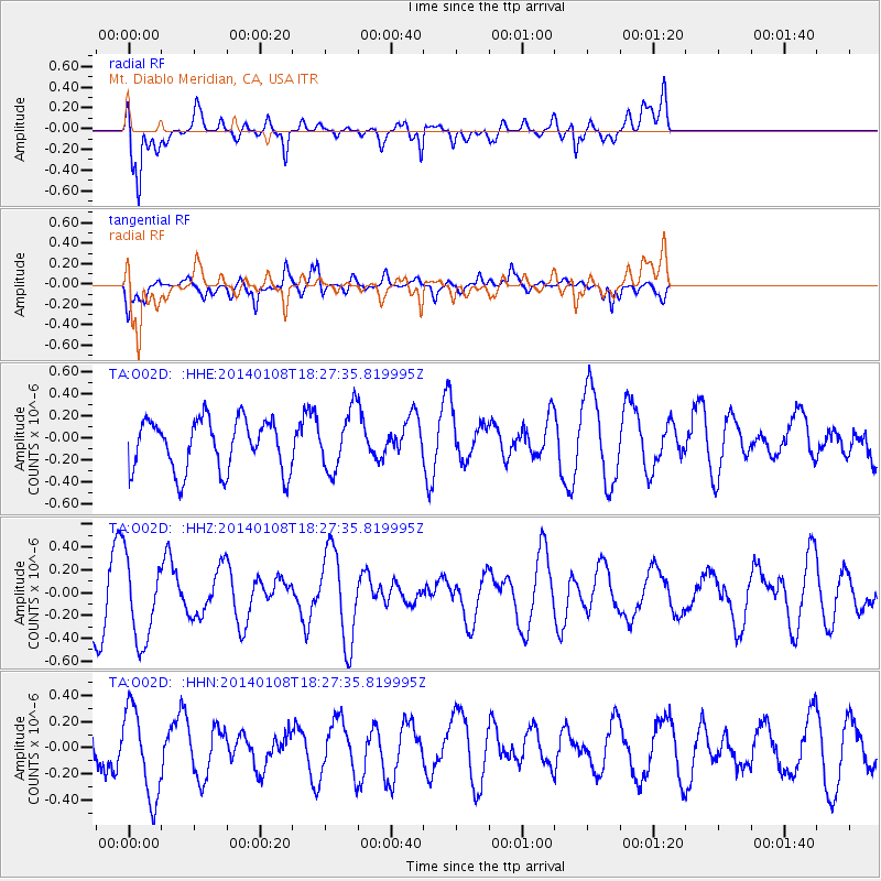
O02D Mt. Diablo Meridian, CA, USA - Earthquake Result Viewer
*The percent match for this event was below the threshold and hence no stack was calculated.
| Earthquake location: |
Southwestern Ryukyu Isl., Japan |
| Earthquake latitude/longitude: |
24.5/123.5 |
| Earthquake time(UTC): |
2014/01/08 (008) 18:15:11 GMT |
| Earthquake Depth: |
73 km |
| Earthquake Magnitude: |
5.3 MW |
| Earthquake Catalog/Contributor: |
ISC/ISC |
|
| Network: |
TA USArray Transportable Network (new EarthScope stations) |
| Station: |
O02D Mt. Diablo Meridian, CA, USA |
| Lat/Lon: |
40.18 N/122.79 W |
| Elevation: |
965 m |
|
| Distance: |
90.9 deg |
| Az: |
44.538 deg |
| Baz: |
303.527 deg |
| Ray Param: |
$rayparam |
*The percent match for this event was below the threshold and hence was not used in the summary stack. |
|
| Radial Match: |
62.787098 % |
| Radial Bump: |
400 |
| Transverse Match: |
59.751595 % |
| Transverse Bump: |
400 |
| SOD ConfigId: |
3390531 |
| Insert Time: |
2019-04-09 22:43:48.098 +0000 |
| GWidth: |
2.5 |
| Max Bumps: |
400 |
| Tol: |
0.001 |
|
Signal To Noise
| Channel | StoN | STA | LTA |
| TA:O02D: :HHZ:20140108T18:27:35.819995Z | 1.6630875 | 3.677421E-7 | 2.2112012E-7 |
| TA:O02D: :HHN:20140108T18:27:35.819995Z | 2.173838 | 3.4060423E-7 | 1.5668336E-7 |
| TA:O02D: :HHE:20140108T18:27:35.819995Z | 1.1221818 | 2.614852E-7 | 2.3301502E-7 |
| Arrivals |
| Ps | |
| PpPs | |
| PsPs/PpSs | |


