You are here: Home > Network List > G - GEOSCOPE Stations List
> Station TAM Tamanrasset, Algeria > Earthquake Result Viewer
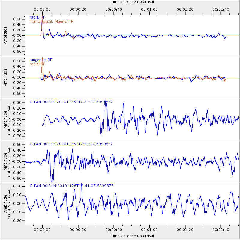
TAM Tamanrasset, Algeria - Earthquake Result Viewer
*The percent match for this event was below the threshold and hence no stack was calculated.
| Earthquake location: |
Southern Iran |
| Earthquake latitude/longitude: |
28.1/52.6 |
| Earthquake time(UTC): |
2010/11/26 (330) 12:33:42 GMT |
| Earthquake Depth: |
8.0 km |
| Earthquake Magnitude: |
5.7 MB, 5.2 MS, 5.5 MW, 5.3 MW |
| Earthquake Catalog/Contributor: |
WHDF/NEIC |
|
| Network: |
G GEOSCOPE |
| Station: |
TAM Tamanrasset, Algeria |
| Lat/Lon: |
22.79 N/5.53 E |
| Elevation: |
1377 m |
|
| Distance: |
42.6 deg |
| Az: |
273.9 deg |
| Baz: |
72.827 deg |
| Ray Param: |
$rayparam |
*The percent match for this event was below the threshold and hence was not used in the summary stack. |
|
| Radial Match: |
77.67644 % |
| Radial Bump: |
347 |
| Transverse Match: |
71.37818 % |
| Transverse Bump: |
400 |
| SOD ConfigId: |
343951 |
| Insert Time: |
2011-05-23 22:15:51.702 +0000 |
| GWidth: |
2.5 |
| Max Bumps: |
400 |
| Tol: |
0.001 |
|
Signal To Noise
| Channel | StoN | STA | LTA |
| G:TAM:00:BHZ:20101126T12:41:07.699987Z | 3.8529663 | 2.0576631E-7 | 5.340465E-8 |
| G:TAM:00:BHN:20101126T12:41:07.699987Z | 0.931297 | 4.801249E-8 | 5.1554437E-8 |
| G:TAM:00:BHE:20101126T12:41:07.699987Z | 2.683333 | 1.1718406E-7 | 4.3671083E-8 |
| Arrivals |
| Ps | |
| PpPs | |
| PsPs/PpSs | |


