You are here: Home > Network List > G - GEOSCOPE Stations List
> Station INU Inuyama, Japan > Earthquake Result Viewer
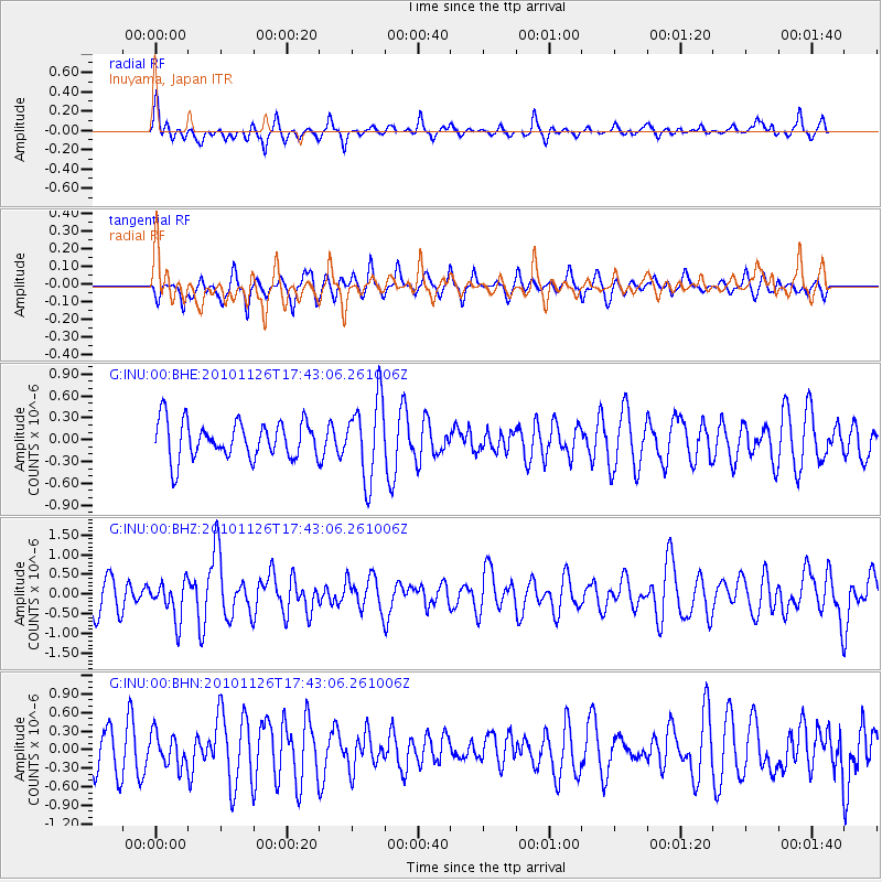
INU Inuyama, Japan - Earthquake Result Viewer
*The percent match for this event was below the threshold and hence no stack was calculated.
| Earthquake location: |
Irian Jaya Region, Indonesia |
| Earthquake latitude/longitude: |
-3.3/131.0 |
| Earthquake time(UTC): |
2010/11/26 (330) 17:36:12 GMT |
| Earthquake Depth: |
22 km |
| Earthquake Magnitude: |
5.7 MB, 5.7 MS, 5.8 MW, 5.8 MW |
| Earthquake Catalog/Contributor: |
WHDF/NEIC |
|
| Network: |
G GEOSCOPE |
| Station: |
INU Inuyama, Japan |
| Lat/Lon: |
35.35 N/137.03 E |
| Elevation: |
132 m |
|
| Distance: |
38.9 deg |
| Az: |
7.836 deg |
| Baz: |
189.585 deg |
| Ray Param: |
$rayparam |
*The percent match for this event was below the threshold and hence was not used in the summary stack. |
|
| Radial Match: |
53.995136 % |
| Radial Bump: |
322 |
| Transverse Match: |
64.517265 % |
| Transverse Bump: |
389 |
| SOD ConfigId: |
343951 |
| Insert Time: |
2011-05-23 22:34:33.342 +0000 |
| GWidth: |
2.5 |
| Max Bumps: |
400 |
| Tol: |
0.001 |
|
Signal To Noise
| Channel | StoN | STA | LTA |
| G:INU:00:BHZ:20101126T17:43:06.261006Z | 1.3253721 | 4.8552323E-7 | 3.6632974E-7 |
| G:INU:00:BHN:20101126T17:43:06.261006Z | 0.8135082 | 2.595036E-7 | 3.1899322E-7 |
| G:INU:00:BHE:20101126T17:43:06.261006Z | 2.1533341 | 5.4547945E-7 | 2.5331852E-7 |
| Arrivals |
| Ps | |
| PpPs | |
| PsPs/PpSs | |


