You are here: Home > Network List > G - GEOSCOPE Stations List
> Station INU Inuyama, Japan > Earthquake Result Viewer
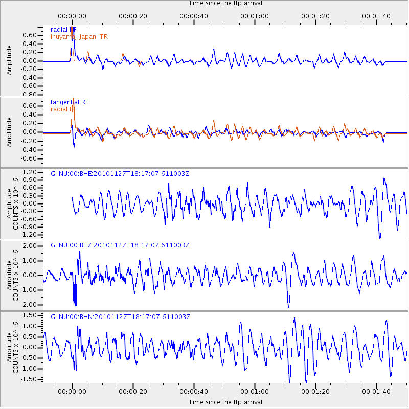
INU Inuyama, Japan - Earthquake Result Viewer
*The percent match for this event was below the threshold and hence no stack was calculated.
| Earthquake location: |
North Of Halmahera, Indonesia |
| Earthquake latitude/longitude: |
3.9/128.1 |
| Earthquake time(UTC): |
2010/11/27 (331) 18:11:13 GMT |
| Earthquake Depth: |
59 km |
| Earthquake Magnitude: |
5.9 MB, 5.7 MW, 5.6 MW |
| Earthquake Catalog/Contributor: |
WHDF/NEIC |
|
| Network: |
G GEOSCOPE |
| Station: |
INU Inuyama, Japan |
| Lat/Lon: |
35.35 N/137.03 E |
| Elevation: |
132 m |
|
| Distance: |
32.4 deg |
| Az: |
13.738 deg |
| Baz: |
196.849 deg |
| Ray Param: |
$rayparam |
*The percent match for this event was below the threshold and hence was not used in the summary stack. |
|
| Radial Match: |
60.08886 % |
| Radial Bump: |
390 |
| Transverse Match: |
68.606834 % |
| Transverse Bump: |
400 |
| SOD ConfigId: |
343951 |
| Insert Time: |
2011-05-23 22:59:48.071 +0000 |
| GWidth: |
2.5 |
| Max Bumps: |
400 |
| Tol: |
0.001 |
|
Signal To Noise
| Channel | StoN | STA | LTA |
| G:INU:00:BHZ:20101127T18:17:07.611003Z | 2.1363983 | 8.253847E-7 | 3.86344E-7 |
| G:INU:00:BHN:20101127T18:17:07.611003Z | 0.9677677 | 4.9694864E-7 | 5.1349997E-7 |
| G:INU:00:BHE:20101127T18:17:07.611003Z | 1.3833948 | 3.763237E-7 | 2.7202913E-7 |
| Arrivals |
| Ps | |
| PpPs | |
| PsPs/PpSs | |


