You are here: Home > Network List > CI - Caltech Regional Seismic Network Stations List
> Station SMM Simmler, CA, USA > Earthquake Result Viewer
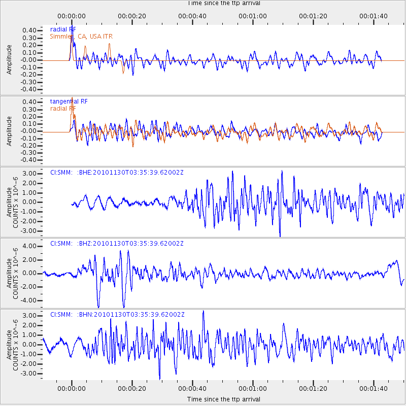
SMM Simmler, CA, USA - Earthquake Result Viewer
*The percent match for this event was below the threshold and hence no stack was calculated.
| Earthquake location: |
Bonin Islands, Japan Region |
| Earthquake latitude/longitude: |
28.4/139.2 |
| Earthquake time(UTC): |
2010/11/30 (334) 03:24:41 GMT |
| Earthquake Depth: |
487 km |
| Earthquake Magnitude: |
5.9 MB, 6.8 MW, 6.8 MW |
| Earthquake Catalog/Contributor: |
WHDF/NEIC |
|
| Network: |
CI Caltech Regional Seismic Network |
| Station: |
SMM Simmler, CA, USA |
| Lat/Lon: |
35.31 N/120.00 W |
| Elevation: |
599 m |
|
| Distance: |
82.2 deg |
| Az: |
54.17 deg |
| Baz: |
299.108 deg |
| Ray Param: |
$rayparam |
*The percent match for this event was below the threshold and hence was not used in the summary stack. |
|
| Radial Match: |
56.468075 % |
| Radial Bump: |
400 |
| Transverse Match: |
51.451122 % |
| Transverse Bump: |
400 |
| SOD ConfigId: |
343951 |
| Insert Time: |
2011-05-23 23:41:31.224 +0000 |
| GWidth: |
2.5 |
| Max Bumps: |
400 |
| Tol: |
0.001 |
|
Signal To Noise
| Channel | StoN | STA | LTA |
| CI:SMM: :BHZ:20101130T03:35:39.62002Z | 3.3865716 | 5.9724067E-7 | 1.7635554E-7 |
| CI:SMM: :BHN:20101130T03:35:39.62002Z | 1.860351 | 6.2877604E-7 | 3.3798784E-7 |
| CI:SMM: :BHE:20101130T03:35:39.62002Z | 1.1685476 | 4.106054E-7 | 3.5138095E-7 |
| Arrivals |
| Ps | |
| PpPs | |
| PsPs/PpSs | |


