You are here: Home > Network List > TA - USArray Transportable Network (new EarthScope stations) Stations List
> Station E31A Nome, ND, USA > Earthquake Result Viewer
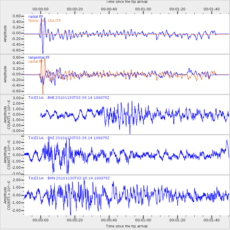
E31A Nome, ND, USA - Earthquake Result Viewer
*The percent match for this event was below the threshold and hence no stack was calculated.
| Earthquake location: |
Bonin Islands, Japan Region |
| Earthquake latitude/longitude: |
28.4/139.2 |
| Earthquake time(UTC): |
2010/11/30 (334) 03:24:41 GMT |
| Earthquake Depth: |
487 km |
| Earthquake Magnitude: |
5.9 MB, 6.8 MW, 6.8 MW |
| Earthquake Catalog/Contributor: |
WHDF/NEIC |
|
| Network: |
TA USArray Transportable Network (new EarthScope stations) |
| Station: |
E31A Nome, ND, USA |
| Lat/Lon: |
46.56 N/97.89 W |
| Elevation: |
427 m |
|
| Distance: |
89.4 deg |
| Az: |
35.383 deg |
| Baz: |
312.309 deg |
| Ray Param: |
$rayparam |
*The percent match for this event was below the threshold and hence was not used in the summary stack. |
|
| Radial Match: |
69.59504 % |
| Radial Bump: |
400 |
| Transverse Match: |
66.10865 % |
| Transverse Bump: |
400 |
| SOD ConfigId: |
343951 |
| Insert Time: |
2011-05-24 00:36:33.432 +0000 |
| GWidth: |
2.5 |
| Max Bumps: |
400 |
| Tol: |
0.001 |
|
Signal To Noise
| Channel | StoN | STA | LTA |
| TA:E31A: :BHZ:20101130T03:36:14.199976Z | 3.2703655 | 8.956119E-7 | 2.738568E-7 |
| TA:E31A: :BHN:20101130T03:36:14.199976Z | 1.4255589 | 5.220811E-7 | 3.6622907E-7 |
| TA:E31A: :BHE:20101130T03:36:14.199976Z | 1.2944357 | 5.7599084E-7 | 4.449745E-7 |
| Arrivals |
| Ps | |
| PpPs | |
| PsPs/PpSs | |


