You are here: Home > Network List > CI - Caltech Regional Seismic Network Stations List
> Station SMM Simmler, CA, USA > Earthquake Result Viewer
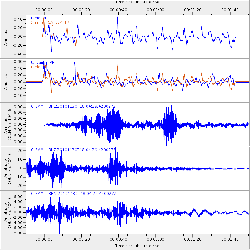
SMM Simmler, CA, USA - Earthquake Result Viewer
*The percent match for this event was below the threshold and hence no stack was calculated.
| Earthquake location: |
Kuril Islands |
| Earthquake latitude/longitude: |
48.9/154.9 |
| Earthquake time(UTC): |
2010/11/30 (334) 17:54:47 GMT |
| Earthquake Depth: |
35 km |
| Earthquake Magnitude: |
5.7 MW, 5.2 MS, 5.4 MB, 5.6 MW |
| Earthquake Catalog/Contributor: |
WHDF/NEIC |
|
| Network: |
CI Caltech Regional Seismic Network |
| Station: |
SMM Simmler, CA, USA |
| Lat/Lon: |
35.31 N/120.00 W |
| Elevation: |
599 m |
|
| Distance: |
61.4 deg |
| Az: |
68.138 deg |
| Baz: |
311.538 deg |
| Ray Param: |
$rayparam |
*The percent match for this event was below the threshold and hence was not used in the summary stack. |
|
| Radial Match: |
45.23249 % |
| Radial Bump: |
400 |
| Transverse Match: |
57.988163 % |
| Transverse Bump: |
400 |
| SOD ConfigId: |
343951 |
| Insert Time: |
2011-05-24 01:22:48.193 +0000 |
| GWidth: |
2.5 |
| Max Bumps: |
400 |
| Tol: |
0.001 |
|
Signal To Noise
| Channel | StoN | STA | LTA |
| CI:SMM: :BHZ:20101130T18:04:29.420027Z | 2.6058078 | 6.3651087E-6 | 2.4426624E-6 |
| CI:SMM: :BHN:20101130T18:04:29.420027Z | 2.9612918 | 2.0328519E-6 | 6.864747E-7 |
| CI:SMM: :BHE:20101130T18:04:29.420027Z | 2.668837 | 3.331335E-6 | 1.2482346E-6 |
| Arrivals |
| Ps | |
| PpPs | |
| PsPs/PpSs | |


