You are here: Home > Network List > KN - Kyrgyz Seismic Telemetry Network Stations List
> Station TKM2 KN.TKM2 > Earthquake Result Viewer
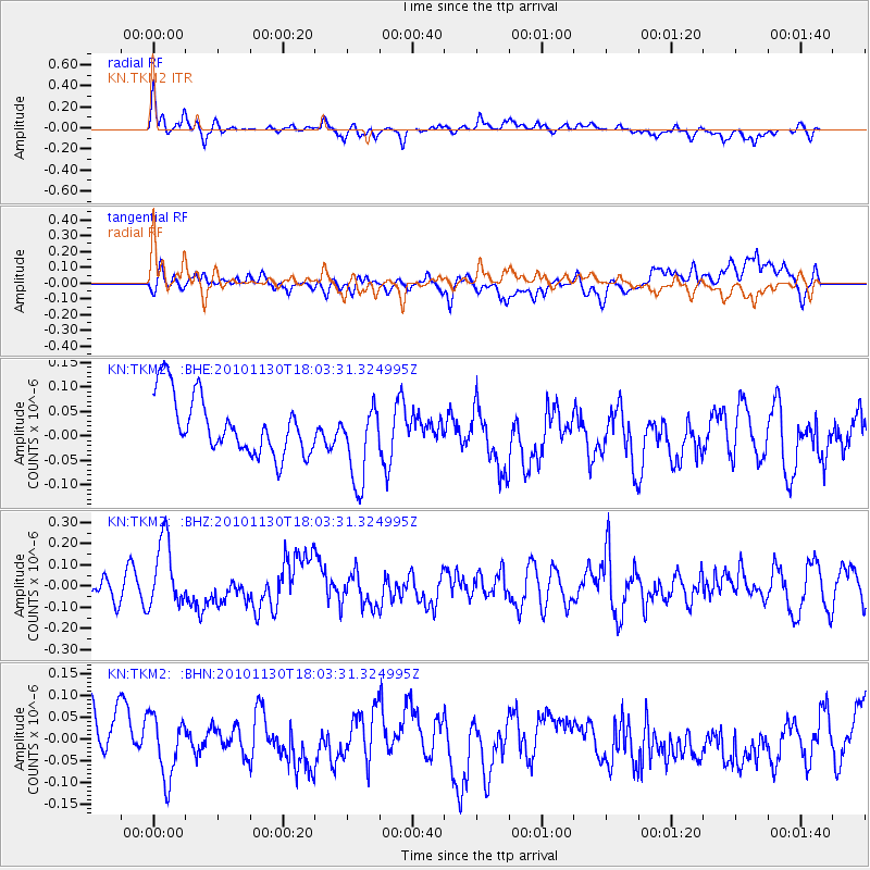
TKM2 KN.TKM2 - Earthquake Result Viewer
*The percent match for this event was below the threshold and hence no stack was calculated.
| Earthquake location: |
Kuril Islands |
| Earthquake latitude/longitude: |
48.9/154.9 |
| Earthquake time(UTC): |
2010/11/30 (334) 17:54:47 GMT |
| Earthquake Depth: |
35 km |
| Earthquake Magnitude: |
5.7 MW, 5.2 MS, 5.4 MB, 5.6 MW |
| Earthquake Catalog/Contributor: |
WHDF/NEIC |
|
| Network: |
KN Kyrgyz Seismic Telemetry Network |
| Station: |
TKM2 KN.TKM2 |
| Lat/Lon: |
42.92 N/75.60 E |
| Elevation: |
2020 m |
|
| Distance: |
53.1 deg |
| Az: |
295.561 deg |
| Baz: |
54.1 deg |
| Ray Param: |
$rayparam |
*The percent match for this event was below the threshold and hence was not used in the summary stack. |
|
| Radial Match: |
72.62913 % |
| Radial Bump: |
400 |
| Transverse Match: |
40.560036 % |
| Transverse Bump: |
400 |
| SOD ConfigId: |
343951 |
| Insert Time: |
2011-05-24 01:35:40.711 +0000 |
| GWidth: |
2.5 |
| Max Bumps: |
400 |
| Tol: |
0.001 |
|
Signal To Noise
| Channel | StoN | STA | LTA |
| KN:TKM2: :BHZ:20101130T18:03:31.324995Z | 2.4515715 | 1.6229063E-7 | 6.619861E-8 |
| KN:TKM2: :BHN:20101130T18:03:31.324995Z | 1.1065247 | 7.0820896E-8 | 6.4003E-8 |
| KN:TKM2: :BHE:20101130T18:03:31.324995Z | 1.3887124 | 8.1895415E-8 | 5.8972194E-8 |
| Arrivals |
| Ps | |
| PpPs | |
| PsPs/PpSs | |


