You are here: Home > Network List > TA - USArray Transportable Network (new EarthScope stations) Stations List
> Station D27A Center, ND, USA > Earthquake Result Viewer
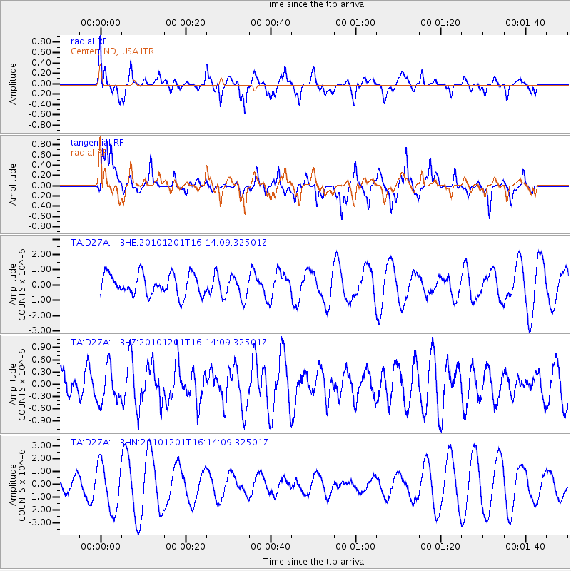
D27A Center, ND, USA - Earthquake Result Viewer
*The percent match for this event was below the threshold and hence no stack was calculated.
| Earthquake location: |
Fiji Islands Region |
| Earthquake latitude/longitude: |
-15.9/-179.0 |
| Earthquake time(UTC): |
2010/12/01 (335) 16:01:27 GMT |
| Earthquake Depth: |
15 km |
| Earthquake Magnitude: |
5.6 MB, 5.9 MS, 6.1 MW, 6.0 MW |
| Earthquake Catalog/Contributor: |
WHDF/NEIC |
|
| Network: |
TA USArray Transportable Network (new EarthScope stations) |
| Station: |
D27A Center, ND, USA |
| Lat/Lon: |
47.11 N/101.53 W |
| Elevation: |
685 m |
|
| Distance: |
93.2 deg |
| Az: |
41.892 deg |
| Baz: |
250.165 deg |
| Ray Param: |
$rayparam |
*The percent match for this event was below the threshold and hence was not used in the summary stack. |
|
| Radial Match: |
56.172283 % |
| Radial Bump: |
400 |
| Transverse Match: |
54.139515 % |
| Transverse Bump: |
320 |
| SOD ConfigId: |
343951 |
| Insert Time: |
2011-05-24 03:13:58.544 +0000 |
| GWidth: |
2.5 |
| Max Bumps: |
400 |
| Tol: |
0.001 |
|
Signal To Noise
| Channel | StoN | STA | LTA |
| TA:D27A: :BHZ:20101201T16:14:09.32501Z | 0.8701165 | 4.325966E-7 | 4.971709E-7 |
| TA:D27A: :BHN:20101201T16:14:09.32501Z | 3.4409366 | 1.8240416E-6 | 5.3010035E-7 |
| TA:D27A: :BHE:20101201T16:14:09.32501Z | 1.1001605 | 7.5913374E-7 | 6.900209E-7 |
| Arrivals |
| Ps | |
| PpPs | |
| PsPs/PpSs | |


