You are here: Home > Network List > US - United States National Seismic Network Stations List
> Station EGMT Eagleton, Montana, USA > Earthquake Result Viewer
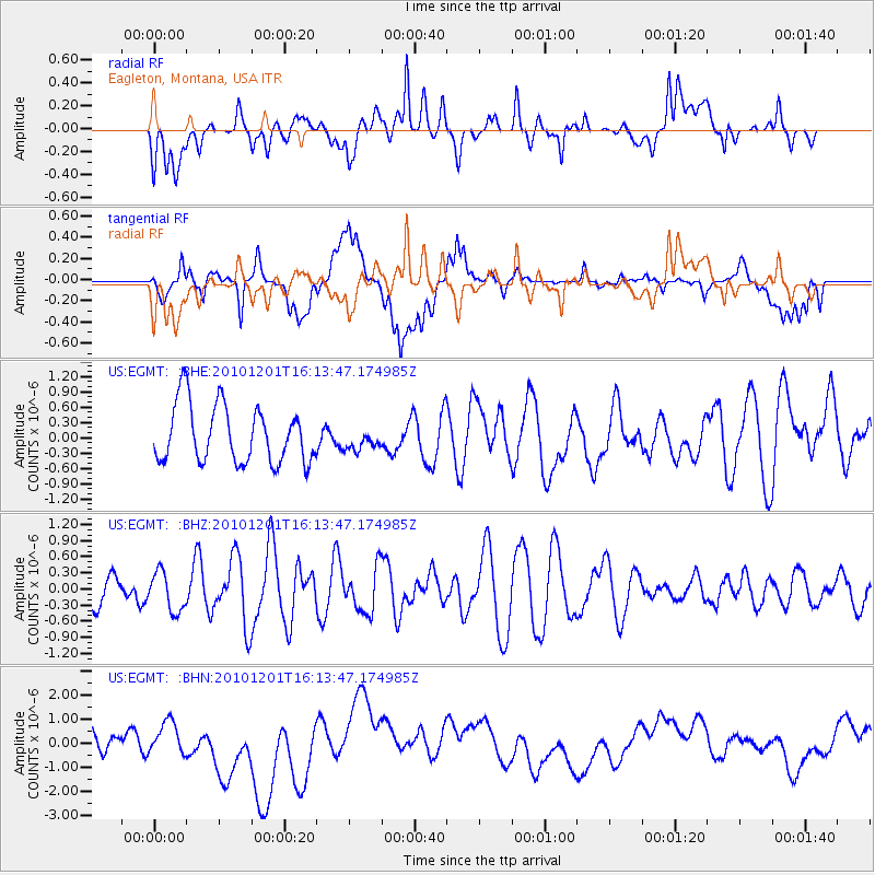
EGMT Eagleton, Montana, USA - Earthquake Result Viewer
*The percent match for this event was below the threshold and hence no stack was calculated.
| Earthquake location: |
Fiji Islands Region |
| Earthquake latitude/longitude: |
-15.9/-179.0 |
| Earthquake time(UTC): |
2010/12/01 (335) 16:01:27 GMT |
| Earthquake Depth: |
15 km |
| Earthquake Magnitude: |
5.6 MB, 5.9 MS, 6.1 MW, 6.0 MW |
| Earthquake Catalog/Contributor: |
WHDF/NEIC |
|
| Network: |
US United States National Seismic Network |
| Station: |
EGMT Eagleton, Montana, USA |
| Lat/Lon: |
48.02 N/109.75 W |
| Elevation: |
1055 m |
|
| Distance: |
88.4 deg |
| Az: |
38.888 deg |
| Baz: |
244.147 deg |
| Ray Param: |
$rayparam |
*The percent match for this event was below the threshold and hence was not used in the summary stack. |
|
| Radial Match: |
47.704758 % |
| Radial Bump: |
400 |
| Transverse Match: |
31.923777 % |
| Transverse Bump: |
400 |
| SOD ConfigId: |
343951 |
| Insert Time: |
2011-05-24 03:26:58.818 +0000 |
| GWidth: |
2.5 |
| Max Bumps: |
400 |
| Tol: |
0.001 |
|
Signal To Noise
| Channel | StoN | STA | LTA |
| US:EGMT: :BHZ:20101201T16:13:47.174985Z | 1.110762 | 3.670619E-7 | 3.304595E-7 |
| US:EGMT: :BHN:20101201T16:13:47.174985Z | 1.5504603 | 5.8215744E-7 | 3.7547392E-7 |
| US:EGMT: :BHE:20101201T16:13:47.174985Z | 0.36432508 | 2.0576775E-7 | 5.647916E-7 |
| Arrivals |
| Ps | |
| PpPs | |
| PsPs/PpSs | |


