You are here: Home > Network List > AK - Alaska Regional Network Stations List
> Station MDM Murphy Dome > Earthquake Result Viewer
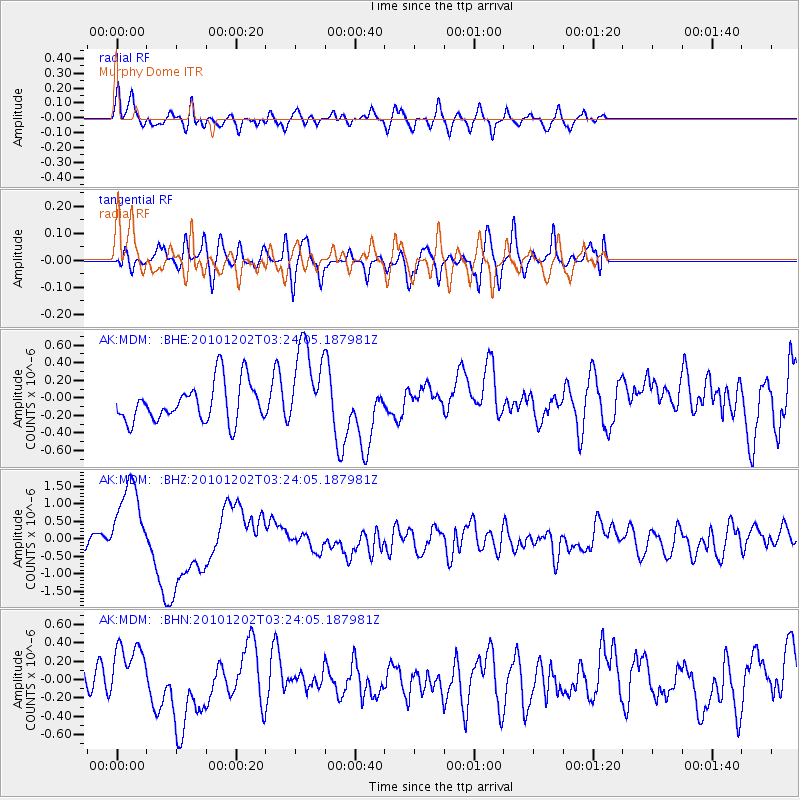
MDM Murphy Dome - Earthquake Result Viewer
*The percent match for this event was below the threshold and hence no stack was calculated.
| Earthquake location: |
New Britain Region, P.N.G. |
| Earthquake latitude/longitude: |
-6.0/150.0 |
| Earthquake time(UTC): |
2010/12/02 (336) 03:12:09 GMT |
| Earthquake Depth: |
33 km |
| Earthquake Magnitude: |
5.9 MB, 6.7 MS, 6.6 MW, 6.6 MW |
| Earthquake Catalog/Contributor: |
WHDF/NEIC |
|
| Network: |
AK Alaska Regional Network |
| Station: |
MDM Murphy Dome |
| Lat/Lon: |
64.96 N/148.23 W |
| Elevation: |
634 m |
|
| Distance: |
83.9 deg |
| Az: |
22.16 deg |
| Baz: |
241.819 deg |
| Ray Param: |
$rayparam |
*The percent match for this event was below the threshold and hence was not used in the summary stack. |
|
| Radial Match: |
64.1926 % |
| Radial Bump: |
400 |
| Transverse Match: |
40.280514 % |
| Transverse Bump: |
400 |
| SOD ConfigId: |
343951 |
| Insert Time: |
2011-05-24 03:35:23.188 +0000 |
| GWidth: |
2.5 |
| Max Bumps: |
400 |
| Tol: |
0.001 |
|
Signal To Noise
| Channel | StoN | STA | LTA |
| AK:MDM: :BHZ:20101202T03:24:05.187981Z | 8.172617 | 1.2104443E-6 | 1.4810975E-7 |
| AK:MDM: :BHN:20101202T03:24:05.187981Z | 1.4733598 | 2.821801E-7 | 1.9152152E-7 |
| AK:MDM: :BHE:20101202T03:24:05.187981Z | 2.2213228 | 4.968459E-7 | 2.236712E-7 |
| Arrivals |
| Ps | |
| PpPs | |
| PsPs/PpSs | |


