You are here: Home > Network List > AZ - ANZA Regional Network Stations List
> Station SMER AZ.SMER > Earthquake Result Viewer
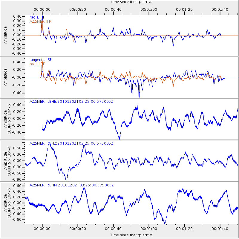
SMER AZ.SMER - Earthquake Result Viewer
*The percent match for this event was below the threshold and hence no stack was calculated.
| Earthquake location: |
New Britain Region, P.N.G. |
| Earthquake latitude/longitude: |
-6.0/150.0 |
| Earthquake time(UTC): |
2010/12/02 (336) 03:12:09 GMT |
| Earthquake Depth: |
33 km |
| Earthquake Magnitude: |
5.9 MB, 6.7 MS, 6.6 MW, 6.6 MW |
| Earthquake Catalog/Contributor: |
WHDF/NEIC |
|
| Network: |
AZ ANZA Regional Network |
| Station: |
SMER AZ.SMER |
| Lat/Lon: |
33.46 N/117.17 W |
| Elevation: |
355 m |
|
| Distance: |
95.6 deg |
| Az: |
57.037 deg |
| Baz: |
266.563 deg |
| Ray Param: |
$rayparam |
*The percent match for this event was below the threshold and hence was not used in the summary stack. |
|
| Radial Match: |
73.28823 % |
| Radial Bump: |
388 |
| Transverse Match: |
73.77996 % |
| Transverse Bump: |
400 |
| SOD ConfigId: |
343951 |
| Insert Time: |
2011-05-24 03:42:21.773 +0000 |
| GWidth: |
2.5 |
| Max Bumps: |
400 |
| Tol: |
0.001 |
|
Signal To Noise
| Channel | StoN | STA | LTA |
| AZ:SMER: :BHZ:20101202T03:25:00.575005Z | 3.0668416 | 4.932749E-7 | 1.6084135E-7 |
| AZ:SMER: :BHN:20101202T03:25:00.575005Z | 1.625425 | 2.7022438E-7 | 1.6624844E-7 |
| AZ:SMER: :BHE:20101202T03:25:00.575005Z | 1.0189053 | 1.4132083E-7 | 1.3869868E-7 |
| Arrivals |
| Ps | |
| PpPs | |
| PsPs/PpSs | |


