You are here: Home > Network List > CI - Caltech Regional Seismic Network Stations List
> Station MPM Manuel Prospect Mine, California, USA > Earthquake Result Viewer
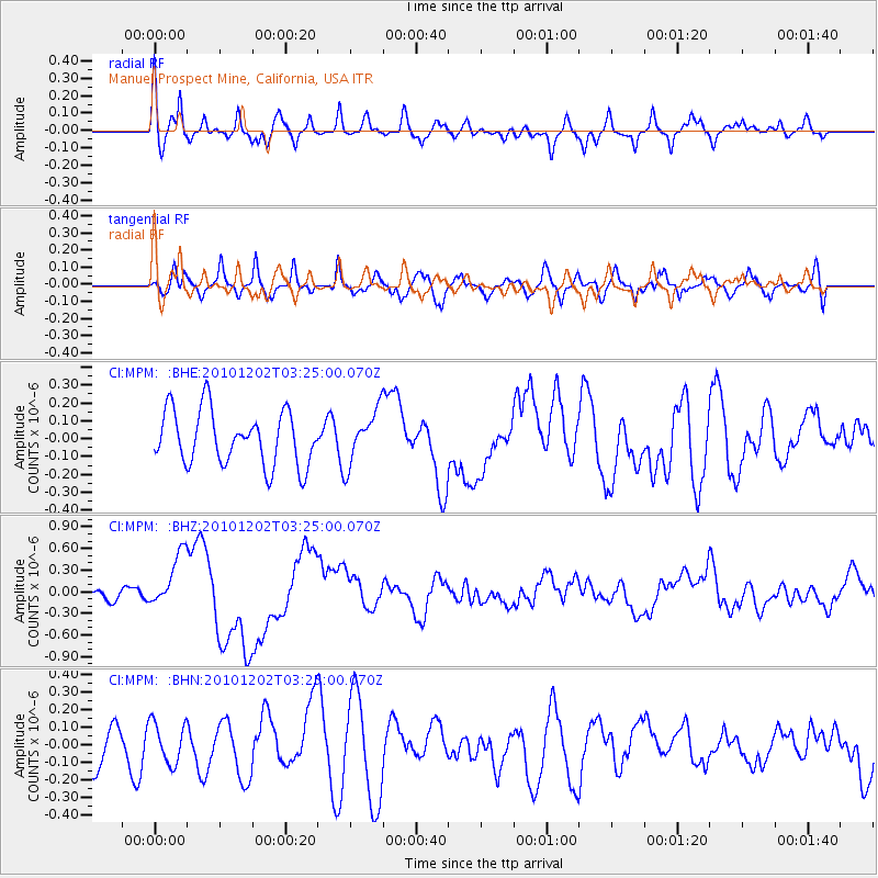
MPM Manuel Prospect Mine, California, USA - Earthquake Result Viewer
*The percent match for this event was below the threshold and hence no stack was calculated.
| Earthquake location: |
New Britain Region, P.N.G. |
| Earthquake latitude/longitude: |
-6.0/150.0 |
| Earthquake time(UTC): |
2010/12/02 (336) 03:12:09 GMT |
| Earthquake Depth: |
33 km |
| Earthquake Magnitude: |
5.9 MB, 6.7 MS, 6.6 MW, 6.6 MW |
| Earthquake Catalog/Contributor: |
WHDF/NEIC |
|
| Network: |
CI Caltech Regional Seismic Network |
| Station: |
MPM Manuel Prospect Mine, California, USA |
| Lat/Lon: |
36.06 N/117.49 W |
| Elevation: |
185 m |
|
| Distance: |
95.5 deg |
| Az: |
54.42 deg |
| Baz: |
266.637 deg |
| Ray Param: |
$rayparam |
*The percent match for this event was below the threshold and hence was not used in the summary stack. |
|
| Radial Match: |
71.27237 % |
| Radial Bump: |
400 |
| Transverse Match: |
47.869884 % |
| Transverse Bump: |
400 |
| SOD ConfigId: |
343951 |
| Insert Time: |
2011-05-24 03:48:42.384 +0000 |
| GWidth: |
2.5 |
| Max Bumps: |
400 |
| Tol: |
0.001 |
|
Signal To Noise
| Channel | StoN | STA | LTA |
| CI:MPM: :BHZ:20101202T03:25:00.070Z | 2.741208 | 3.7399442E-7 | 1.3643417E-7 |
| CI:MPM: :BHN:20101202T03:25:00.070Z | 0.6462559 | 1.1582439E-7 | 1.7922373E-7 |
| CI:MPM: :BHE:20101202T03:25:00.070Z | 0.9853311 | 1.4913583E-7 | 1.5135605E-7 |
| Arrivals |
| Ps | |
| PpPs | |
| PsPs/PpSs | |


