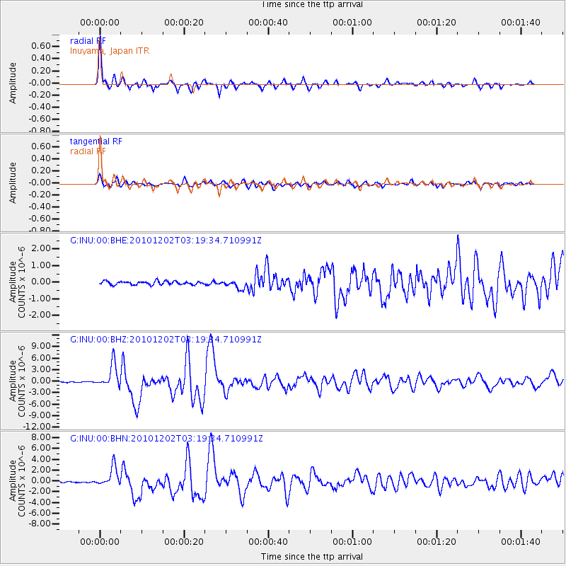
INU Inuyama, Japan - Earthquake Result Viewer
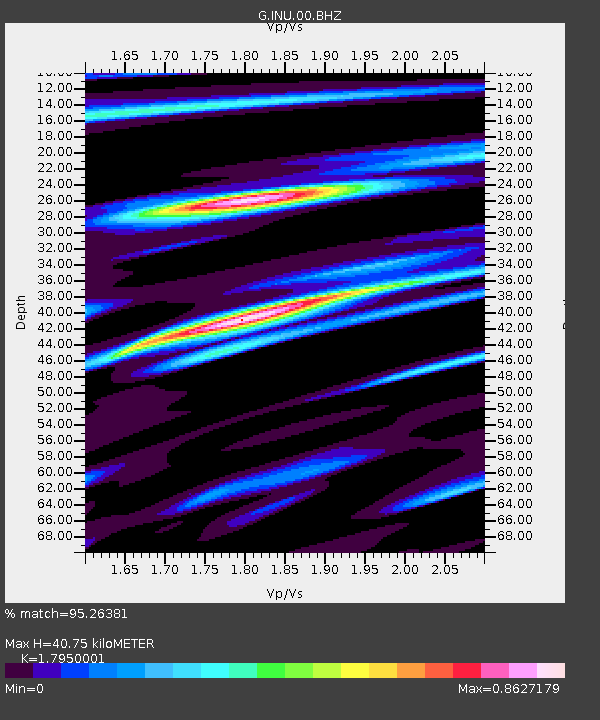
Earthquake location: New Britain Region, P.N.G.
Earthquake latitude/longitude: -6.0/150.0
Earthquake time(UTC): 2010/12/02 (336) 03:12:09 GMT
Earthquake Depth: 33 km
Earthquake Magnitude: 5.9 MB, 6.7 MS, 6.6 MW, 6.6 MW
Earthquake Catalog/Contributor: WHDF/NEIC
Network: G GEOSCOPE
Station: INU Inuyama, Japan
Lat/Lon: 35.35 N/137.03 E
Elevation: 132 m
Distance: 42.9 deg
Az: 344.391 deg
Baz: 160.89 deg
Ray Param: 0.07282934
Estimated Moho Depth: 40.75 km
Estimated Crust Vp/Vs: 1.80
Assumed Crust Vp: 6.461 km/s
Estimated Crust Vs: 3.6 km/s
Estimated Crust Poisson's Ratio: 0.27
Radial Match: 95.26381 %
Radial Bump: 322
Transverse Match: 84.43832 %
Transverse Bump: 400
SOD ConfigId: 343951
Insert Time: 2011-05-24 03:54:38.522 +0000
GWidth: 2.5
Max Bumps: 400
Tol: 0.001

Signal To Noise

ChannelStoNSTALTA
G:INU:00:BHZ:20101202T03:19:34.710991Z25.7985343.1691736E-61.2284318E-7
G:INU:00:BHN:20101202T03:19:34.710991Z12.9934831.8525919E-61.4257856E-7
G:INU:00:BHE:20101202T03:19:34.710991Z2.4973642.5764186E-71.0316552E-7
Arrivals
Ps5.4 SECOND
PpPs16 SECOND
PsPs/PpSs22 SECOND