You are here: Home > Network List > BK - Berkeley Digital Seismograph Network Stations List
> Station HUMO Hull Mountain, OR > Earthquake Result Viewer
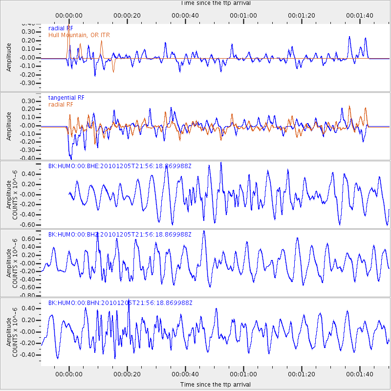
HUMO Hull Mountain, OR - Earthquake Result Viewer
*The percent match for this event was below the threshold and hence no stack was calculated.
| Earthquake location: |
Southeast Of Easter Island |
| Earthquake latitude/longitude: |
-36.2/-100.8 |
| Earthquake time(UTC): |
2010/12/05 (339) 21:44:35 GMT |
| Earthquake Depth: |
13 km |
| Earthquake Magnitude: |
5.5 MB, 5.5 MS, 5.9 MW, 5.9 MW |
| Earthquake Catalog/Contributor: |
WHDF/NEIC |
|
| Network: |
BK Berkeley Digital Seismograph Network |
| Station: |
HUMO Hull Mountain, OR |
| Lat/Lon: |
42.61 N/122.96 W |
| Elevation: |
555 m |
|
| Distance: |
81.0 deg |
| Az: |
343.646 deg |
| Baz: |
162.039 deg |
| Ray Param: |
$rayparam |
*The percent match for this event was below the threshold and hence was not used in the summary stack. |
|
| Radial Match: |
49.664772 % |
| Radial Bump: |
400 |
| Transverse Match: |
61.038456 % |
| Transverse Bump: |
400 |
| SOD ConfigId: |
343951 |
| Insert Time: |
2011-05-24 04:27:18.804 +0000 |
| GWidth: |
2.5 |
| Max Bumps: |
400 |
| Tol: |
0.001 |
|
Signal To Noise
| Channel | StoN | STA | LTA |
| BK:HUMO:00:BHZ:20101205T21:56:18.869988Z | 1.2159513 | 1.7389954E-7 | 1.4301521E-7 |
| BK:HUMO:00:BHN:20101205T21:56:18.869988Z | 0.69171464 | 1.3729547E-7 | 1.9848572E-7 |
| BK:HUMO:00:BHE:20101205T21:56:18.869988Z | 2.4328642 | 3.4350202E-7 | 1.4119243E-7 |
| Arrivals |
| Ps | |
| PpPs | |
| PsPs/PpSs | |


