You are here: Home > Network List > TA - USArray Transportable Network (new EarthScope stations) Stations List
> Station C06D Leavenworth, WQ, USA > Earthquake Result Viewer
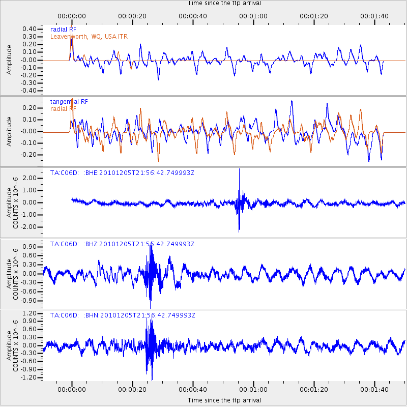
C06D Leavenworth, WQ, USA - Earthquake Result Viewer
*The percent match for this event was below the threshold and hence no stack was calculated.
| Earthquake location: |
Southeast Of Easter Island |
| Earthquake latitude/longitude: |
-36.2/-100.8 |
| Earthquake time(UTC): |
2010/12/05 (339) 21:44:35 GMT |
| Earthquake Depth: |
13 km |
| Earthquake Magnitude: |
5.5 MB, 5.5 MS, 5.9 MW, 5.9 MW |
| Earthquake Catalog/Contributor: |
WHDF/NEIC |
|
| Network: |
TA USArray Transportable Network (new EarthScope stations) |
| Station: |
C06D Leavenworth, WQ, USA |
| Lat/Lon: |
47.92 N/120.89 W |
| Elevation: |
544 m |
|
| Distance: |
85.7 deg |
| Az: |
346.617 deg |
| Baz: |
163.845 deg |
| Ray Param: |
$rayparam |
*The percent match for this event was below the threshold and hence was not used in the summary stack. |
|
| Radial Match: |
58.54909 % |
| Radial Bump: |
400 |
| Transverse Match: |
54.924236 % |
| Transverse Bump: |
400 |
| SOD ConfigId: |
343951 |
| Insert Time: |
2011-05-24 04:57:53.871 +0000 |
| GWidth: |
2.5 |
| Max Bumps: |
400 |
| Tol: |
0.001 |
|
Signal To Noise
| Channel | StoN | STA | LTA |
| TA:C06D: :BHZ:20101205T21:56:42.749993Z | 0.74060327 | 1.1331933E-7 | 1.530095E-7 |
| TA:C06D: :BHN:20101205T21:56:42.749993Z | 1.0300651 | 1.343375E-7 | 1.3041652E-7 |
| TA:C06D: :BHE:20101205T21:56:42.749993Z | 1.3611914 | 1.7481995E-7 | 1.2843157E-7 |
| Arrivals |
| Ps | |
| PpPs | |
| PsPs/PpSs | |


