You are here: Home > Network List > TA - USArray Transportable Network (new EarthScope stations) Stations List
> Station K37A Belmond, IA, USA > Earthquake Result Viewer
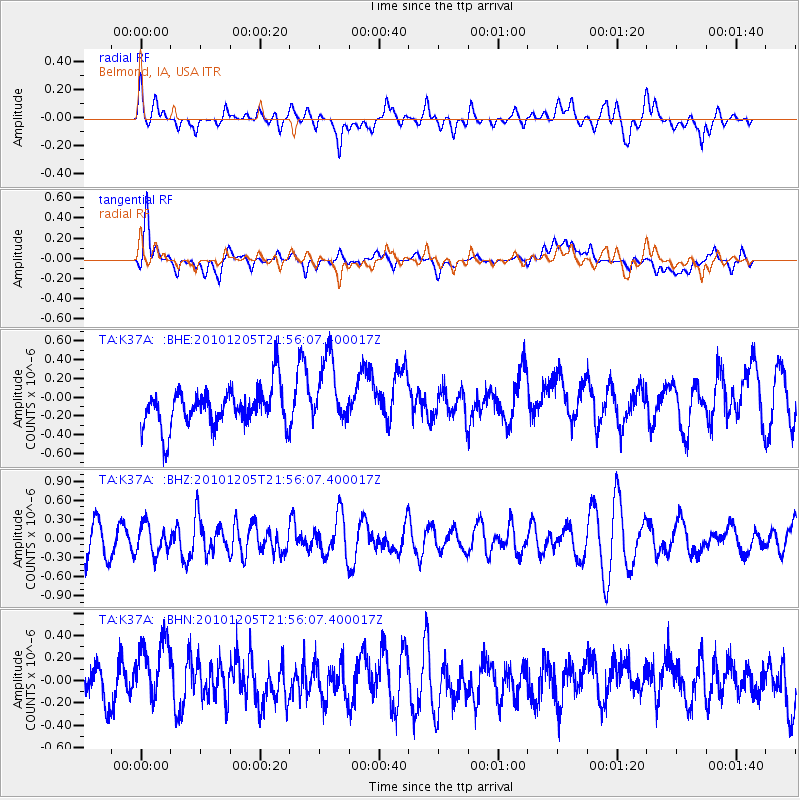
K37A Belmond, IA, USA - Earthquake Result Viewer
*The percent match for this event was below the threshold and hence no stack was calculated.
| Earthquake location: |
Southeast Of Easter Island |
| Earthquake latitude/longitude: |
-36.2/-100.8 |
| Earthquake time(UTC): |
2010/12/05 (339) 21:44:35 GMT |
| Earthquake Depth: |
13 km |
| Earthquake Magnitude: |
5.5 MB, 5.5 MS, 5.9 MW, 5.9 MW |
| Earthquake Catalog/Contributor: |
WHDF/NEIC |
|
| Network: |
TA USArray Transportable Network (new EarthScope stations) |
| Station: |
K37A Belmond, IA, USA |
| Lat/Lon: |
42.77 N/93.64 W |
| Elevation: |
365 m |
|
| Distance: |
78.9 deg |
| Az: |
5.387 deg |
| Baz: |
185.917 deg |
| Ray Param: |
$rayparam |
*The percent match for this event was below the threshold and hence was not used in the summary stack. |
|
| Radial Match: |
48.7128 % |
| Radial Bump: |
400 |
| Transverse Match: |
44.523434 % |
| Transverse Bump: |
400 |
| SOD ConfigId: |
343951 |
| Insert Time: |
2011-05-24 04:59:16.356 +0000 |
| GWidth: |
2.5 |
| Max Bumps: |
400 |
| Tol: |
0.001 |
|
Signal To Noise
| Channel | StoN | STA | LTA |
| TA:K37A: :BHZ:20101205T21:56:07.400017Z | 1.1785109 | 2.3017706E-7 | 1.9531177E-7 |
| TA:K37A: :BHN:20101205T21:56:07.400017Z | 1.531952 | 3.0249015E-7 | 1.9745407E-7 |
| TA:K37A: :BHE:20101205T21:56:07.400017Z | 1.7780628 | 3.720411E-7 | 2.0923956E-7 |
| Arrivals |
| Ps | |
| PpPs | |
| PsPs/PpSs | |


