You are here: Home > Network List > MN - MEDNET Project Stations List
> Station TIP Timpagrande, Italy > Earthquake Result Viewer
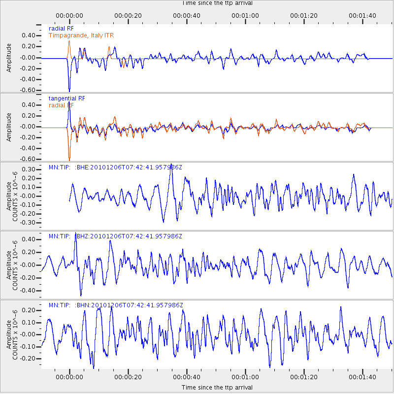
TIP Timpagrande, Italy - Earthquake Result Viewer
*The percent match for this event was below the threshold and hence no stack was calculated.
| Earthquake location: |
Near East Coast Of Honshu, Japan |
| Earthquake latitude/longitude: |
40.9/143.0 |
| Earthquake time(UTC): |
2010/12/06 (340) 07:30:32 GMT |
| Earthquake Depth: |
22 km |
| Earthquake Magnitude: |
5.6 MB, 5.4 MS, 5.7 MW, 5.7 MW |
| Earthquake Catalog/Contributor: |
WHDF/NEIC |
|
| Network: |
MN MEDNET Project |
| Station: |
TIP Timpagrande, Italy |
| Lat/Lon: |
39.18 N/16.76 E |
| Elevation: |
789 m |
|
| Distance: |
86.4 deg |
| Az: |
321.071 deg |
| Baz: |
37.791 deg |
| Ray Param: |
$rayparam |
*The percent match for this event was below the threshold and hence was not used in the summary stack. |
|
| Radial Match: |
53.747192 % |
| Radial Bump: |
400 |
| Transverse Match: |
83.09565 % |
| Transverse Bump: |
400 |
| SOD ConfigId: |
343951 |
| Insert Time: |
2011-05-24 05:42:47.416 +0000 |
| GWidth: |
2.5 |
| Max Bumps: |
400 |
| Tol: |
0.001 |
|
Signal To Noise
| Channel | StoN | STA | LTA |
| MN:TIP: :BHZ:20101206T07:42:41.957986Z | 3.4262576 | 2.2856335E-7 | 6.670933E-8 |
| MN:TIP: :BHN:20101206T07:42:41.957986Z | 1.3656746 | 9.02358E-8 | 6.607416E-8 |
| MN:TIP: :BHE:20101206T07:42:41.957986Z | 2.6225529 | 1.782797E-7 | 6.797945E-8 |
| Arrivals |
| Ps | |
| PpPs | |
| PsPs/PpSs | |


