You are here: Home > Network List > TA - USArray Transportable Network (new EarthScope stations) Stations List
> Station F29A Eureka, SD, USA > Earthquake Result Viewer
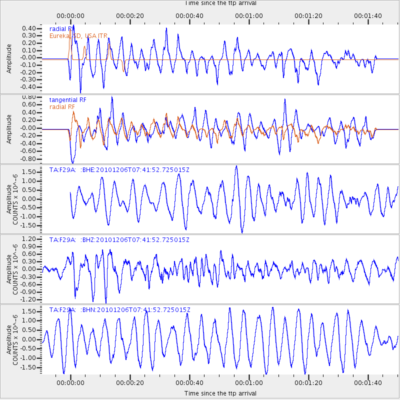
F29A Eureka, SD, USA - Earthquake Result Viewer
*The percent match for this event was below the threshold and hence no stack was calculated.
| Earthquake location: |
Near East Coast Of Honshu, Japan |
| Earthquake latitude/longitude: |
40.9/143.0 |
| Earthquake time(UTC): |
2010/12/06 (340) 07:30:32 GMT |
| Earthquake Depth: |
22 km |
| Earthquake Magnitude: |
5.6 MB, 5.4 MS, 5.7 MW, 5.7 MW |
| Earthquake Catalog/Contributor: |
WHDF/NEIC |
|
| Network: |
TA USArray Transportable Network (new EarthScope stations) |
| Station: |
F29A Eureka, SD, USA |
| Lat/Lon: |
45.83 N/99.83 W |
| Elevation: |
575 m |
|
| Distance: |
77.1 deg |
| Az: |
39.645 deg |
| Baz: |
316.234 deg |
| Ray Param: |
$rayparam |
*The percent match for this event was below the threshold and hence was not used in the summary stack. |
|
| Radial Match: |
45.633022 % |
| Radial Bump: |
386 |
| Transverse Match: |
55.742466 % |
| Transverse Bump: |
400 |
| SOD ConfigId: |
343951 |
| Insert Time: |
2011-05-24 06:01:01.255 +0000 |
| GWidth: |
2.5 |
| Max Bumps: |
400 |
| Tol: |
0.001 |
|
Signal To Noise
| Channel | StoN | STA | LTA |
| TA:F29A: :BHZ:20101206T07:41:52.725015Z | 2.8793828 | 4.999037E-7 | 1.736149E-7 |
| TA:F29A: :BHN:20101206T07:41:52.725015Z | 1.8174462 | 9.234689E-7 | 5.081135E-7 |
| TA:F29A: :BHE:20101206T07:41:52.725015Z | 1.0769037 | 6.899553E-7 | 6.406843E-7 |
| Arrivals |
| Ps | |
| PpPs | |
| PsPs/PpSs | |


