You are here: Home > Network List > AZ - ANZA Regional Network Stations List
> Station SMER AZ.SMER > Earthquake Result Viewer
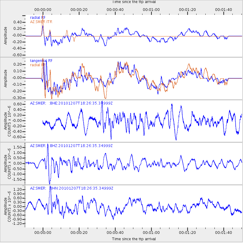
SMER AZ.SMER - Earthquake Result Viewer
*The percent match for this event was below the threshold and hence no stack was calculated.
| Earthquake location: |
Komandorskiye Ostrova Region |
| Earthquake latitude/longitude: |
54.4/169.1 |
| Earthquake time(UTC): |
2010/12/07 (341) 18:17:39 GMT |
| Earthquake Depth: |
10 km |
| Earthquake Magnitude: |
6.1 MB, 5.5 MS, 5.8 MW, 5.8 MW |
| Earthquake Catalog/Contributor: |
WHDF/NEIC |
|
| Network: |
AZ ANZA Regional Network |
| Station: |
SMER AZ.SMER |
| Lat/Lon: |
33.46 N/117.17 W |
| Elevation: |
355 m |
|
| Distance: |
54.4 deg |
| Az: |
80.726 deg |
| Baz: |
316.296 deg |
| Ray Param: |
$rayparam |
*The percent match for this event was below the threshold and hence was not used in the summary stack. |
|
| Radial Match: |
61.83591 % |
| Radial Bump: |
400 |
| Transverse Match: |
59.365868 % |
| Transverse Bump: |
400 |
| SOD ConfigId: |
343951 |
| Insert Time: |
2011-05-24 07:05:11.540 +0000 |
| GWidth: |
2.5 |
| Max Bumps: |
400 |
| Tol: |
0.001 |
|
Signal To Noise
| Channel | StoN | STA | LTA |
| AZ:SMER: :BHZ:20101207T18:26:35.34999Z | 5.325439 | 9.4637664E-7 | 1.7770867E-7 |
| AZ:SMER: :BHN:20101207T18:26:35.34999Z | 3.0795693 | 6.6109544E-7 | 2.1467139E-7 |
| AZ:SMER: :BHE:20101207T18:26:35.34999Z | 1.4411615 | 2.8787633E-7 | 1.99753E-7 |
| Arrivals |
| Ps | |
| PpPs | |
| PsPs/PpSs | |


