You are here: Home > Network List > CI - Caltech Regional Seismic Network Stations List
> Station MPM Manuel Prospect Mine, California, USA > Earthquake Result Viewer
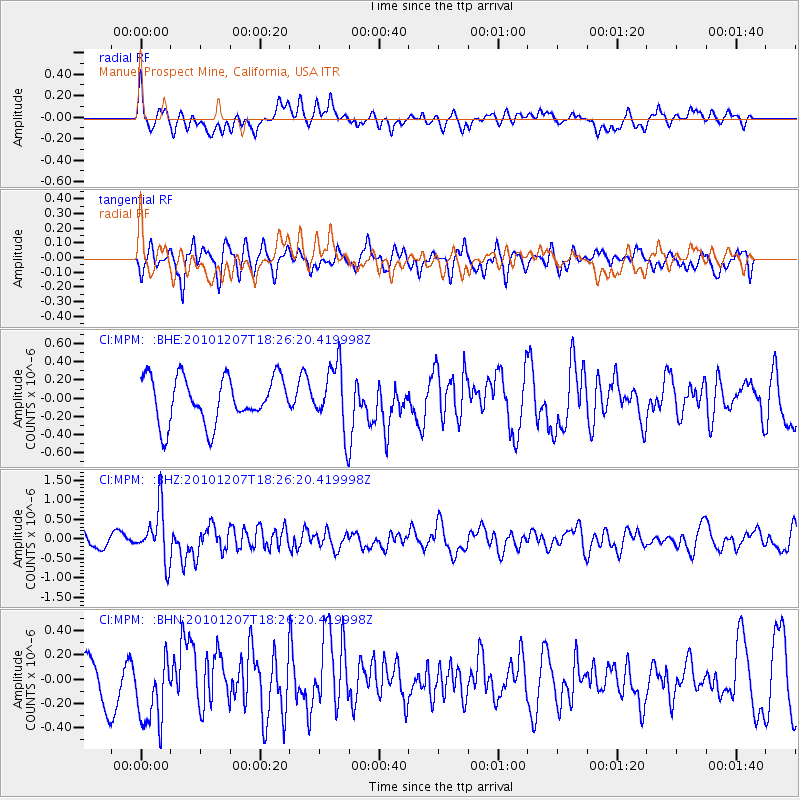
MPM Manuel Prospect Mine, California, USA - Earthquake Result Viewer
*The percent match for this event was below the threshold and hence no stack was calculated.
| Earthquake location: |
Komandorskiye Ostrova Region |
| Earthquake latitude/longitude: |
54.4/169.1 |
| Earthquake time(UTC): |
2010/12/07 (341) 18:17:39 GMT |
| Earthquake Depth: |
10 km |
| Earthquake Magnitude: |
6.1 MB, 5.5 MS, 5.8 MW, 5.8 MW |
| Earthquake Catalog/Contributor: |
WHDF/NEIC |
|
| Network: |
CI Caltech Regional Seismic Network |
| Station: |
MPM Manuel Prospect Mine, California, USA |
| Lat/Lon: |
36.06 N/117.49 W |
| Elevation: |
185 m |
|
| Distance: |
52.4 deg |
| Az: |
78.698 deg |
| Baz: |
314.905 deg |
| Ray Param: |
$rayparam |
*The percent match for this event was below the threshold and hence was not used in the summary stack. |
|
| Radial Match: |
65.7545 % |
| Radial Bump: |
400 |
| Transverse Match: |
54.624577 % |
| Transverse Bump: |
400 |
| SOD ConfigId: |
343951 |
| Insert Time: |
2011-05-24 07:20:51.809 +0000 |
| GWidth: |
2.5 |
| Max Bumps: |
400 |
| Tol: |
0.001 |
|
Signal To Noise
| Channel | StoN | STA | LTA |
| CI:MPM: :BHZ:20101207T18:26:20.419998Z | 3.4959402 | 6.6974343E-7 | 1.915775E-7 |
| CI:MPM: :BHN:20101207T18:26:20.419998Z | 2.0267525 | 2.8697968E-7 | 1.4159583E-7 |
| CI:MPM: :BHE:20101207T18:26:20.419998Z | 1.4172846 | 3.532316E-7 | 2.4923122E-7 |
| Arrivals |
| Ps | |
| PpPs | |
| PsPs/PpSs | |


