You are here: Home > Network List > CI - Caltech Regional Seismic Network Stations List
> Station SMM Simmler, CA, USA > Earthquake Result Viewer
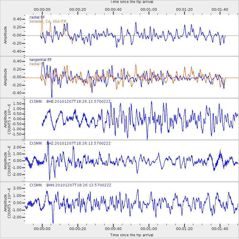
SMM Simmler, CA, USA - Earthquake Result Viewer
*The percent match for this event was below the threshold and hence no stack was calculated.
| Earthquake location: |
Komandorskiye Ostrova Region |
| Earthquake latitude/longitude: |
54.4/169.1 |
| Earthquake time(UTC): |
2010/12/07 (341) 18:17:39 GMT |
| Earthquake Depth: |
10 km |
| Earthquake Magnitude: |
6.1 MB, 5.5 MS, 5.8 MW, 5.8 MW |
| Earthquake Catalog/Contributor: |
WHDF/NEIC |
|
| Network: |
CI Caltech Regional Seismic Network |
| Station: |
SMM Simmler, CA, USA |
| Lat/Lon: |
35.31 N/120.00 W |
| Elevation: |
599 m |
|
| Distance: |
51.4 deg |
| Az: |
81.198 deg |
| Baz: |
314.992 deg |
| Ray Param: |
$rayparam |
*The percent match for this event was below the threshold and hence was not used in the summary stack. |
|
| Radial Match: |
61.97801 % |
| Radial Bump: |
400 |
| Transverse Match: |
63.212418 % |
| Transverse Bump: |
400 |
| SOD ConfigId: |
343951 |
| Insert Time: |
2011-05-24 07:25:02.649 +0000 |
| GWidth: |
2.5 |
| Max Bumps: |
400 |
| Tol: |
0.001 |
|
Signal To Noise
| Channel | StoN | STA | LTA |
| CI:SMM: :BHZ:20101207T18:26:13.570022Z | 3.5219753 | 1.2708197E-6 | 3.6082582E-7 |
| CI:SMM: :BHN:20101207T18:26:13.570022Z | 2.7073193 | 8.2188075E-7 | 3.0357734E-7 |
| CI:SMM: :BHE:20101207T18:26:13.570022Z | 1.2490896 | 5.805114E-7 | 4.6474764E-7 |
| Arrivals |
| Ps | |
| PpPs | |
| PsPs/PpSs | |


