You are here: Home > Network List > TA - USArray Transportable Network (new EarthScope stations) Stations List
> Station H17A Grant Village (NPS), Yellowstone Nt. Park, WY, USA > Earthquake Result Viewer
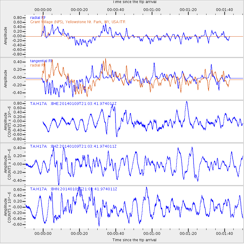
H17A Grant Village (NPS), Yellowstone Nt. Park, WY, USA - Earthquake Result Viewer
*The percent match for this event was below the threshold and hence no stack was calculated.
| Earthquake location: |
Cuba Region |
| Earthquake latitude/longitude: |
23.2/-80.7 |
| Earthquake time(UTC): |
2014/01/09 (009) 20:57:43 GMT |
| Earthquake Depth: |
6.7 km |
| Earthquake Magnitude: |
5.0 MW |
| Earthquake Catalog/Contributor: |
ISC/ISC |
|
| Network: |
TA USArray Transportable Network (new EarthScope stations) |
| Station: |
H17A Grant Village (NPS), Yellowstone Nt. Park, WY, USA |
| Lat/Lon: |
44.40 N/110.58 W |
| Elevation: |
2400 m |
|
| Distance: |
32.3 deg |
| Az: |
318.116 deg |
| Baz: |
121.03 deg |
| Ray Param: |
$rayparam |
*The percent match for this event was below the threshold and hence was not used in the summary stack. |
|
| Radial Match: |
43.620827 % |
| Radial Bump: |
400 |
| Transverse Match: |
56.39397 % |
| Transverse Bump: |
400 |
| SOD ConfigId: |
3390531 |
| Insert Time: |
2019-04-09 23:10:58.146 +0000 |
| GWidth: |
2.5 |
| Max Bumps: |
400 |
| Tol: |
0.001 |
|
Signal To Noise
| Channel | StoN | STA | LTA |
| TA:H17A: :BHZ:20140109T21:03:41.974011Z | 1.0514778 | 1.2353155E-7 | 1.17483744E-7 |
| TA:H17A: :BHN:20140109T21:03:41.974011Z | 1.5540295 | 3.506227E-7 | 2.2562166E-7 |
| TA:H17A: :BHE:20140109T21:03:41.974011Z | 2.0591328 | 3.5671508E-7 | 1.7323559E-7 |
| Arrivals |
| Ps | |
| PpPs | |
| PsPs/PpSs | |


