You are here: Home > Network List > TA - USArray Transportable Network (new EarthScope stations) Stations List
> Station MDND Maddock, ND, USA > Earthquake Result Viewer
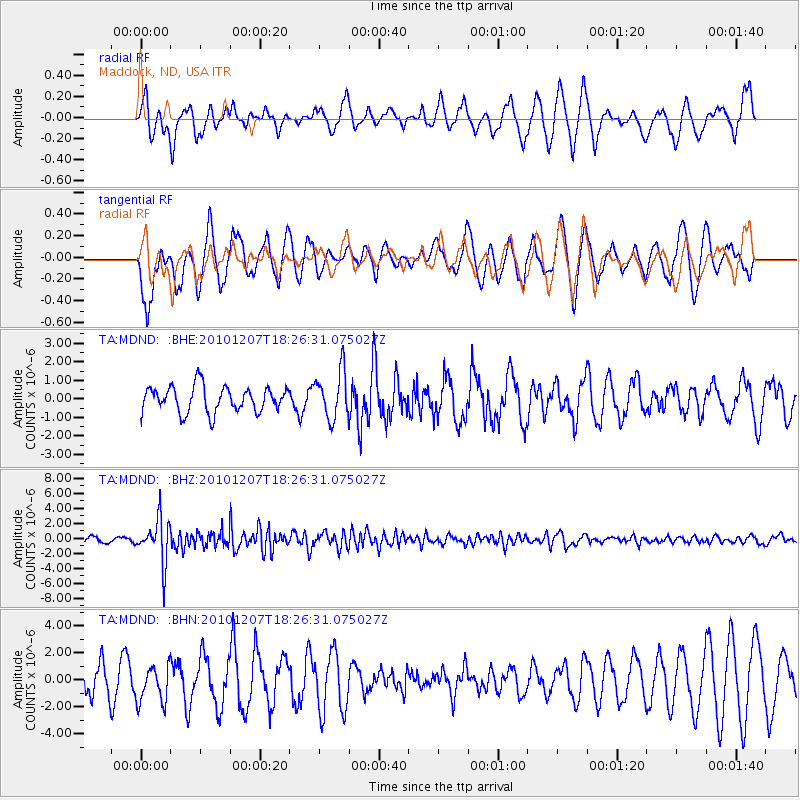
MDND Maddock, ND, USA - Earthquake Result Viewer
*The percent match for this event was below the threshold and hence no stack was calculated.
| Earthquake location: |
Komandorskiye Ostrova Region |
| Earthquake latitude/longitude: |
54.4/169.1 |
| Earthquake time(UTC): |
2010/12/07 (341) 18:17:39 GMT |
| Earthquake Depth: |
10 km |
| Earthquake Magnitude: |
6.1 MB, 5.5 MS, 5.8 MW, 5.8 MW |
| Earthquake Catalog/Contributor: |
WHDF/NEIC |
|
| Network: |
TA USArray Transportable Network (new EarthScope stations) |
| Station: |
MDND Maddock, ND, USA |
| Lat/Lon: |
47.85 N/99.60 W |
| Elevation: |
479 m |
|
| Distance: |
53.8 deg |
| Az: |
56.557 deg |
| Baz: |
313.529 deg |
| Ray Param: |
$rayparam |
*The percent match for this event was below the threshold and hence was not used in the summary stack. |
|
| Radial Match: |
35.241245 % |
| Radial Bump: |
333 |
| Transverse Match: |
57.418694 % |
| Transverse Bump: |
328 |
| SOD ConfigId: |
343951 |
| Insert Time: |
2011-05-24 08:11:59.004 +0000 |
| GWidth: |
2.5 |
| Max Bumps: |
400 |
| Tol: |
0.001 |
|
Signal To Noise
| Channel | StoN | STA | LTA |
| TA:MDND: :BHZ:20101207T18:26:31.075027Z | 7.7977357 | 2.8735333E-6 | 3.685087E-7 |
| TA:MDND: :BHN:20101207T18:26:31.075027Z | 0.9421695 | 1.373592E-6 | 1.4579032E-6 |
| TA:MDND: :BHE:20101207T18:26:31.075027Z | 1.8554007 | 1.2822798E-6 | 6.9110666E-7 |
| Arrivals |
| Ps | |
| PpPs | |
| PsPs/PpSs | |


