You are here: Home > Network List > IU - Global Seismograph Network (GSN - IRIS/USGS) Stations List
> Station MAKZ Makanchi, Kazakhstan > Earthquake Result Viewer
MAKZ Makanchi, Kazakhstan - Earthquake Result Viewer
*The percent match for this event was below the threshold and hence no stack was calculated.
| Earthquake location: |
Kuril Islands |
| Earthquake latitude/longitude: |
48.2/154.1 |
| Earthquake time(UTC): |
2014/01/10 (010) 18:03:00 GMT |
| Earthquake Depth: |
82 km |
| Earthquake Magnitude: |
5.1 MW |
| Earthquake Catalog/Contributor: |
ISC/ISC |
|
| Network: |
IU Global Seismograph Network (GSN - IRIS/USGS) |
| Station: |
MAKZ Makanchi, Kazakhstan |
| Lat/Lon: |
46.81 N/81.98 E |
| Elevation: |
600 m |
|
| Distance: |
47.1 deg |
| Az: |
296.763 deg |
| Baz: |
60.445 deg |
| Ray Param: |
$rayparam |
*The percent match for this event was below the threshold and hence was not used in the summary stack. |
|
| Radial Match: |
59.06288 % |
| Radial Bump: |
400 |
| Transverse Match: |
69.81031 % |
| Transverse Bump: |
400 |
| SOD ConfigId: |
3390531 |
| Insert Time: |
2019-04-09 23:17:40.553 +0000 |
| GWidth: |
2.5 |
| Max Bumps: |
400 |
| Tol: |
0.001 |
|
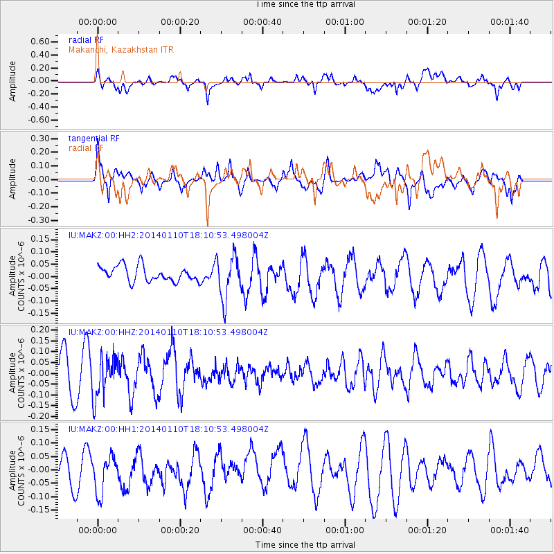
Signal To Noise
| Channel | StoN | STA | LTA |
| IU:MAKZ:00:HHZ:20140110T18:10:53.498004Z | 1.0806167 | 9.116568E-8 | 8.4364494E-8 |
| IU:MAKZ:00:HH1:20140110T18:10:53.498004Z | 1.4354868 | 8.088909E-8 | 5.6349585E-8 |
| IU:MAKZ:00:HH2:20140110T18:10:53.498004Z | 2.8731298 | 8.9758835E-8 | 3.1240788E-8 |
| Arrivals |
| Ps | |
| PpPs | |
| PsPs/PpSs | |


