You are here: Home > Network List > TA - USArray Transportable Network (new EarthScope stations) Stations List
> Station 634A China Grove, San Antonio TX, USA > Earthquake Result Viewer
634A China Grove, San Antonio TX, USA - Earthquake Result Viewer

| Earthquake location: |
Komandorskiye Ostrova Region |
| Earthquake latitude/longitude: |
54.4/169.1 |
| Earthquake time(UTC): |
2010/12/07 (341) 18:17:39 GMT |
| Earthquake Depth: |
10 km |
| Earthquake Magnitude: |
6.1 MB, 5.5 MS, 5.8 MW, 5.8 MW |
| Earthquake Catalog/Contributor: |
WHDF/NEIC |
|
| Network: |
TA USArray Transportable Network (new EarthScope stations) |
| Station: |
634A China Grove, San Antonio TX, USA |
| Lat/Lon: |
29.38 N/98.35 W |
| Elevation: |
188 m |
|
| Distance: |
68.1 deg |
| Az: |
70.026 deg |
| Baz: |
320.932 deg |
| Ray Param: |
0.056535397 |
| Estimated Moho Depth: |
26.75 km |
| Estimated Crust Vp/Vs: |
1.74 |
| Assumed Crust Vp: |
6.347 km/s |
| Estimated Crust Vs: |
3.653 km/s |
| Estimated Crust Poisson's Ratio: |
0.25 |
|
| Radial Match: |
81.82585 % |
| Radial Bump: |
400 |
| Transverse Match: |
74.304794 % |
| Transverse Bump: |
400 |
| SOD ConfigId: |
343951 |
| Insert Time: |
2011-05-24 09:40:25.447 +0000 |
| GWidth: |
2.5 |
| Max Bumps: |
400 |
| Tol: |
0.001 |
|
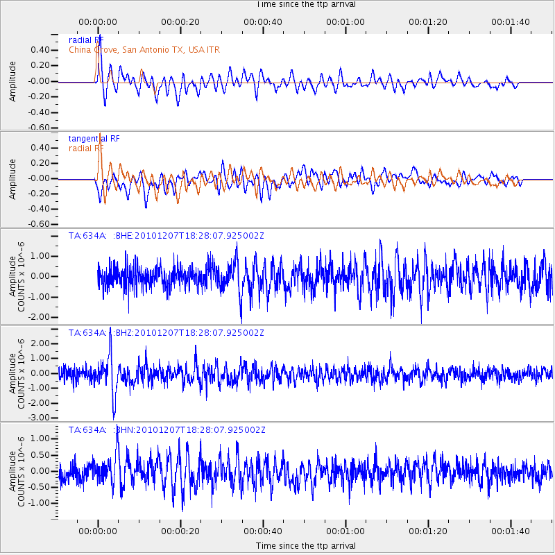
Signal To Noise
| Channel | StoN | STA | LTA |
| TA:634A: :BHZ:20101207T18:28:07.925002Z | 3.263337 | 1.3354936E-6 | 4.0924175E-7 |
| TA:634A: :BHN:20101207T18:28:07.925002Z | 1.9516311 | 4.7344562E-7 | 2.4258972E-7 |
| TA:634A: :BHE:20101207T18:28:07.925002Z | 1.7544028 | 7.7593376E-7 | 4.42278E-7 |
| Arrivals |
| Ps | 3.2 SECOND |
| PpPs | 11 SECOND |
| PsPs/PpSs | 14 SECOND |


