FRD AZ.FRD - Earthquake Result Viewer
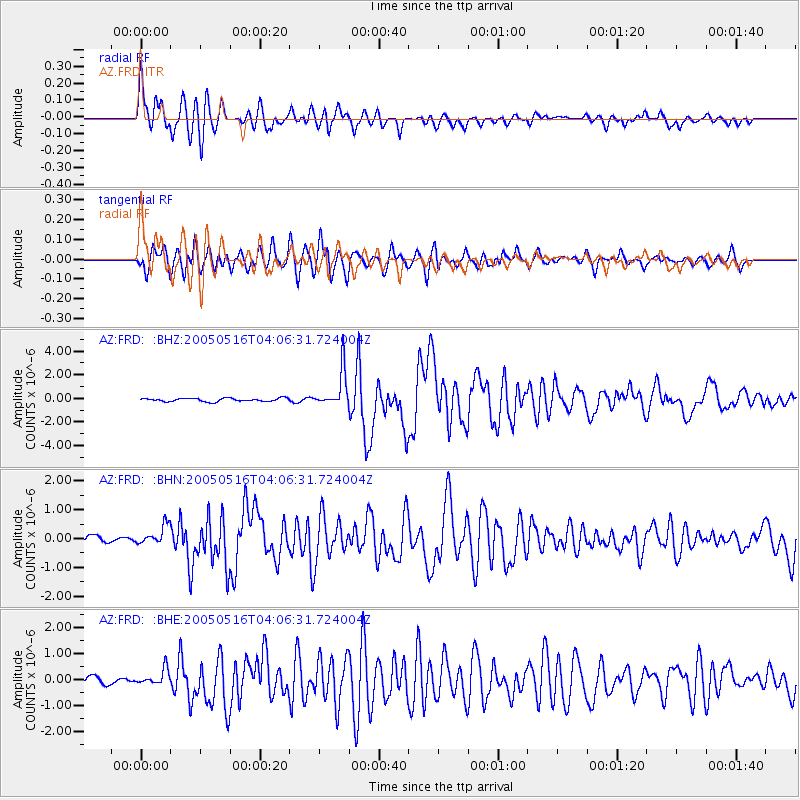
Earthquake location: South Of Kermadec Islands
Earthquake latitude/longitude: -32.6/-179.4
Earthquake time(UTC): 2005/05/16 (136) 03:54:14 GMT
Earthquake Depth: 34 km
Earthquake Magnitude: 6.2 MB, 6.4 MS, 6.6 MW, 6.6 MW
Earthquake Catalog/Contributor: WHDF/NEIC
Network: AZ ANZA Regional Network
Station: FRD AZ.FRD
Lat/Lon: 33.49 N/116.60 W
Elevation: 1164 m
Distance: 88.4 deg
Az: 48.005 deg
Baz: 228.661 deg
Ray Param: 0.04259746
Estimated Moho Depth: 15.5 km
Estimated Crust Vp/Vs: 2.09
Assumed Crust Vp: 6.264 km/s
Estimated Crust Vs: 3.004 km/s
Estimated Crust Poisson's Ratio: 0.35
Radial Match: 93.72207 %
Radial Bump: 400
Transverse Match: 90.70754 %
Transverse Bump: 400
SOD ConfigId: 32974
Insert Time: 2010-02-26 19:12:35.706 +0000
GWidth: 2.5
Max Bumps: 400
Tol: 0.001

Signal To Noise

ChannelStoNSTALTA
AZ:FRD: :BHN:20050516T04:06:31.724004Z2.70581753.3504477E-71.2382387E-7
AZ:FRD: :BHE:20050516T04:06:31.724004Z1.73676962.959349E-71.7039389E-7
AZ:FRD: :BHZ:20050516T04:06:31.724004Z11.2009551.5610055E-61.393636E-7
Arrivals
Ps2.7 SECOND
PpPs7.5 SECOND
PsPs/PpSs10 SECOND