You are here: Home > Network List > TA - USArray Transportable Network (new EarthScope stations) Stations List
> Station O48A Farmland, IN, USA > Earthquake Result Viewer
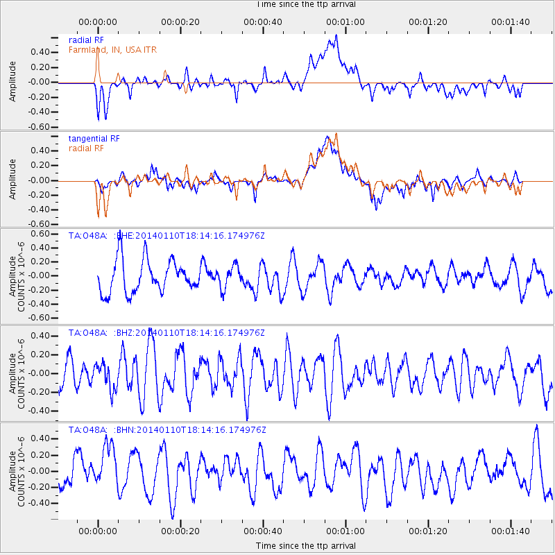
O48A Farmland, IN, USA - Earthquake Result Viewer
*The percent match for this event was below the threshold and hence no stack was calculated.
| Earthquake location: |
Kuril Islands |
| Earthquake latitude/longitude: |
48.2/154.1 |
| Earthquake time(UTC): |
2014/01/10 (010) 18:03:00 GMT |
| Earthquake Depth: |
82 km |
| Earthquake Magnitude: |
5.1 MW |
| Earthquake Catalog/Contributor: |
ISC/ISC |
|
| Network: |
TA USArray Transportable Network (new EarthScope stations) |
| Station: |
O48A Farmland, IN, USA |
| Lat/Lon: |
40.26 N/85.16 W |
| Elevation: |
300 m |
|
| Distance: |
77.5 deg |
| Az: |
42.357 deg |
| Baz: |
323.904 deg |
| Ray Param: |
$rayparam |
*The percent match for this event was below the threshold and hence was not used in the summary stack. |
|
| Radial Match: |
61.098587 % |
| Radial Bump: |
400 |
| Transverse Match: |
51.77913 % |
| Transverse Bump: |
400 |
| SOD ConfigId: |
3390531 |
| Insert Time: |
2019-04-09 23:20:18.926 +0000 |
| GWidth: |
2.5 |
| Max Bumps: |
400 |
| Tol: |
0.001 |
|
Signal To Noise
| Channel | StoN | STA | LTA |
| TA:O48A: :BHZ:20140110T18:14:16.174976Z | 0.84663653 | 1.420938E-7 | 1.678333E-7 |
| TA:O48A: :BHN:20140110T18:14:16.174976Z | 1.1478441 | 3.3919804E-7 | 2.955088E-7 |
| TA:O48A: :BHE:20140110T18:14:16.174976Z | 0.6911652 | 1.6060554E-7 | 2.3236925E-7 |
| Arrivals |
| Ps | |
| PpPs | |
| PsPs/PpSs | |


