You are here: Home > Network List > TA - USArray Transportable Network (new EarthScope stations) Stations List
> Station S56A Natural Bridge, VA, USA > Earthquake Result Viewer
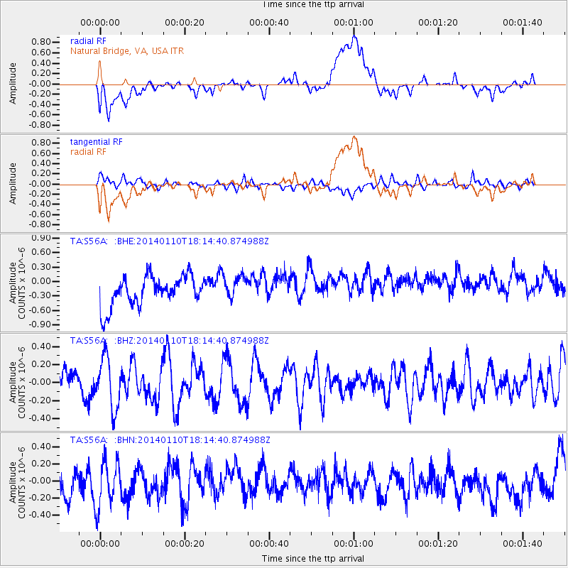
S56A Natural Bridge, VA, USA - Earthquake Result Viewer
*The percent match for this event was below the threshold and hence no stack was calculated.
| Earthquake location: |
Kuril Islands |
| Earthquake latitude/longitude: |
48.2/154.1 |
| Earthquake time(UTC): |
2014/01/10 (010) 18:03:00 GMT |
| Earthquake Depth: |
82 km |
| Earthquake Magnitude: |
5.1 MW |
| Earthquake Catalog/Contributor: |
ISC/ISC |
|
| Network: |
TA USArray Transportable Network (new EarthScope stations) |
| Station: |
S56A Natural Bridge, VA, USA |
| Lat/Lon: |
37.68 N/79.57 W |
| Elevation: |
449 m |
|
| Distance: |
82.1 deg |
| Az: |
40.193 deg |
| Baz: |
327.023 deg |
| Ray Param: |
$rayparam |
*The percent match for this event was below the threshold and hence was not used in the summary stack. |
|
| Radial Match: |
28.501204 % |
| Radial Bump: |
400 |
| Transverse Match: |
47.32754 % |
| Transverse Bump: |
400 |
| SOD ConfigId: |
3390531 |
| Insert Time: |
2019-04-09 23:20:32.451 +0000 |
| GWidth: |
2.5 |
| Max Bumps: |
400 |
| Tol: |
0.001 |
|
Signal To Noise
| Channel | StoN | STA | LTA |
| TA:S56A: :BHZ:20140110T18:14:40.874988Z | 1.053353 | 2.8659906E-7 | 2.7208264E-7 |
| TA:S56A: :BHN:20140110T18:14:40.874988Z | 1.2449032 | 3.1314968E-7 | 2.515454E-7 |
| TA:S56A: :BHE:20140110T18:14:40.874988Z | 0.79667896 | 2.4719435E-7 | 3.1028102E-7 |
| Arrivals |
| Ps | |
| PpPs | |
| PsPs/PpSs | |


