You are here: Home > Network List > TA - USArray Transportable Network (new EarthScope stations) Stations List
> Station W57A Gilead, NC, USA > Earthquake Result Viewer
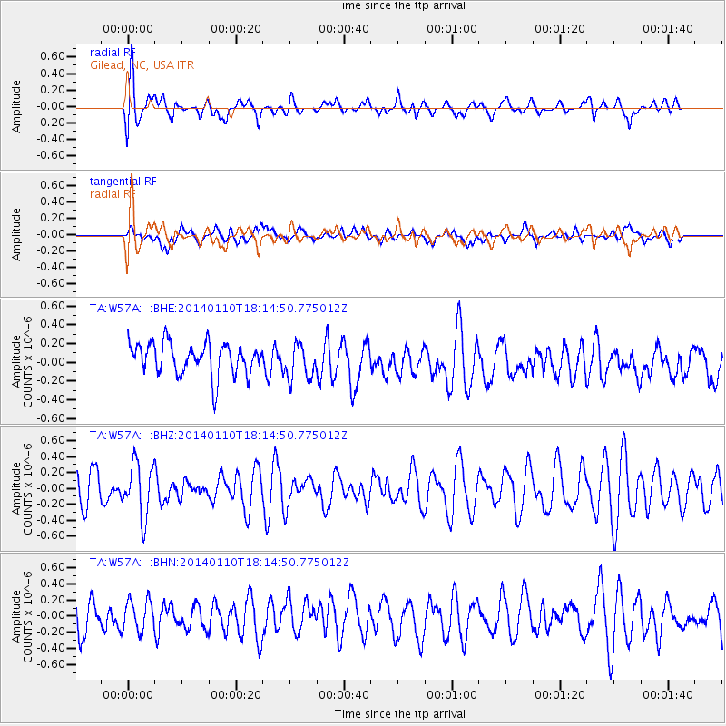
W57A Gilead, NC, USA - Earthquake Result Viewer
*The percent match for this event was below the threshold and hence no stack was calculated.
| Earthquake location: |
Kuril Islands |
| Earthquake latitude/longitude: |
48.2/154.1 |
| Earthquake time(UTC): |
2014/01/10 (010) 18:03:00 GMT |
| Earthquake Depth: |
82 km |
| Earthquake Magnitude: |
5.1 MW |
| Earthquake Catalog/Contributor: |
ISC/ISC |
|
| Network: |
TA USArray Transportable Network (new EarthScope stations) |
| Station: |
W57A Gilead, NC, USA |
| Lat/Lon: |
35.15 N/79.99 W |
| Elevation: |
85 m |
|
| Distance: |
84.0 deg |
| Az: |
41.866 deg |
| Baz: |
326.973 deg |
| Ray Param: |
$rayparam |
*The percent match for this event was below the threshold and hence was not used in the summary stack. |
|
| Radial Match: |
69.737144 % |
| Radial Bump: |
400 |
| Transverse Match: |
37.130955 % |
| Transverse Bump: |
400 |
| SOD ConfigId: |
3390531 |
| Insert Time: |
2019-04-09 23:20:46.060 +0000 |
| GWidth: |
2.5 |
| Max Bumps: |
400 |
| Tol: |
0.001 |
|
Signal To Noise
| Channel | StoN | STA | LTA |
| TA:W57A: :BHZ:20140110T18:14:50.775012Z | 1.37295 | 3.3934336E-7 | 2.4716368E-7 |
| TA:W57A: :BHN:20140110T18:14:50.775012Z | 0.82096374 | 1.8874135E-7 | 2.299022E-7 |
| TA:W57A: :BHE:20140110T18:14:50.775012Z | 1.0971513 | 1.861644E-7 | 1.6967978E-7 |
| Arrivals |
| Ps | |
| PpPs | |
| PsPs/PpSs | |


