You are here: Home > Network List > US - United States National Seismic Network Stations List
> Station MIAR Mount Ida, Arkansas, USA > Earthquake Result Viewer
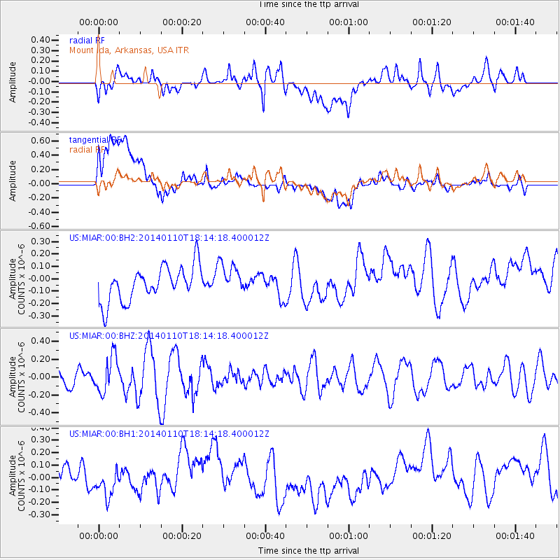
MIAR Mount Ida, Arkansas, USA - Earthquake Result Viewer
*The percent match for this event was below the threshold and hence no stack was calculated.
| Earthquake location: |
Kuril Islands |
| Earthquake latitude/longitude: |
48.2/154.1 |
| Earthquake time(UTC): |
2014/01/10 (010) 18:03:00 GMT |
| Earthquake Depth: |
82 km |
| Earthquake Magnitude: |
5.1 MW |
| Earthquake Catalog/Contributor: |
ISC/ISC |
|
| Network: |
US United States National Seismic Network |
| Station: |
MIAR Mount Ida, Arkansas, USA |
| Lat/Lon: |
34.55 N/93.58 W |
| Elevation: |
207 m |
|
| Distance: |
77.9 deg |
| Az: |
51.349 deg |
| Baz: |
320.718 deg |
| Ray Param: |
$rayparam |
*The percent match for this event was below the threshold and hence was not used in the summary stack. |
|
| Radial Match: |
50.559277 % |
| Radial Bump: |
400 |
| Transverse Match: |
26.896732 % |
| Transverse Bump: |
400 |
| SOD ConfigId: |
3390531 |
| Insert Time: |
2019-04-09 23:21:17.104 +0000 |
| GWidth: |
2.5 |
| Max Bumps: |
400 |
| Tol: |
0.001 |
|
Signal To Noise
| Channel | StoN | STA | LTA |
| US:MIAR:00:BHZ:20140110T18:14:18.400012Z | 2.140804 | 2.0619203E-7 | 9.6315226E-8 |
| US:MIAR:00:BH1:20140110T18:14:18.400012Z | 0.5191675 | 8.405946E-8 | 1.6191203E-7 |
| US:MIAR:00:BH2:20140110T18:14:18.400012Z | 0.87005156 | 1.2100347E-7 | 1.3907619E-7 |
| Arrivals |
| Ps | |
| PpPs | |
| PsPs/PpSs | |


