You are here: Home > Network List > TA - USArray Transportable Network (new EarthScope stations) Stations List
> Station O38A Galt, MO, USA > Earthquake Result Viewer
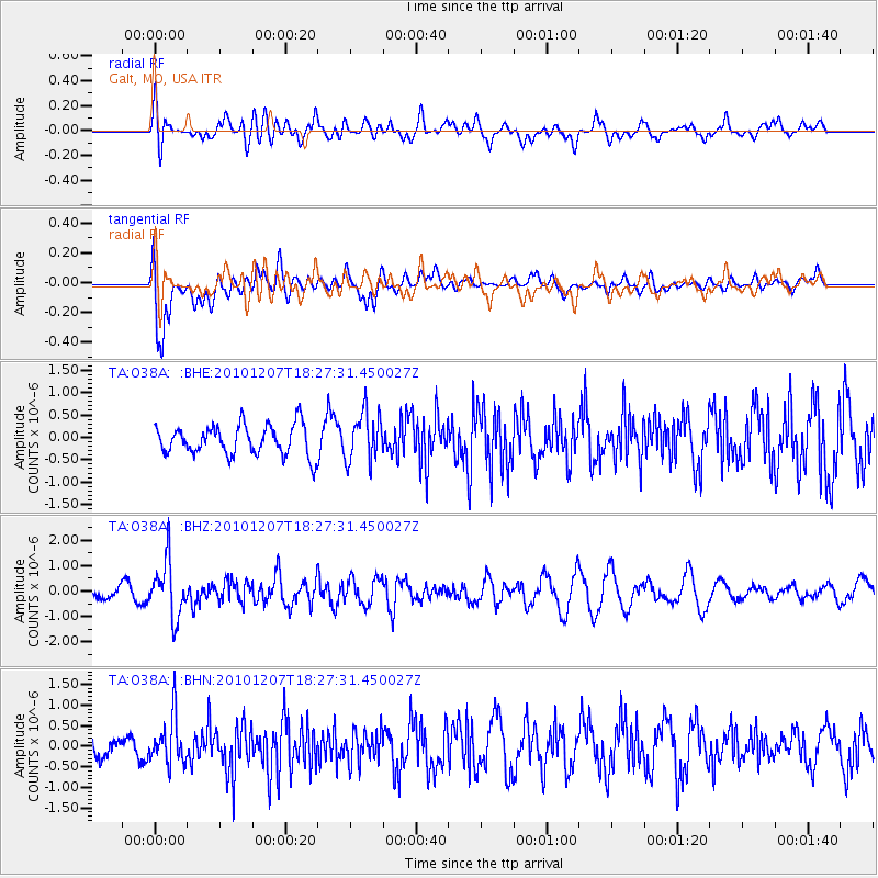
O38A Galt, MO, USA - Earthquake Result Viewer
*The percent match for this event was below the threshold and hence no stack was calculated.
| Earthquake location: |
Komandorskiye Ostrova Region |
| Earthquake latitude/longitude: |
54.4/169.1 |
| Earthquake time(UTC): |
2010/12/07 (341) 18:17:39 GMT |
| Earthquake Depth: |
10 km |
| Earthquake Magnitude: |
6.1 MB, 5.5 MS, 5.8 MW, 5.8 MW |
| Earthquake Catalog/Contributor: |
WHDF/NEIC |
|
| Network: |
TA USArray Transportable Network (new EarthScope stations) |
| Station: |
O38A Galt, MO, USA |
| Lat/Lon: |
40.12 N/93.47 W |
| Elevation: |
266 m |
|
| Distance: |
62.4 deg |
| Az: |
59.059 deg |
| Baz: |
319.108 deg |
| Ray Param: |
$rayparam |
*The percent match for this event was below the threshold and hence was not used in the summary stack. |
|
| Radial Match: |
60.69633 % |
| Radial Bump: |
400 |
| Transverse Match: |
72.65773 % |
| Transverse Bump: |
400 |
| SOD ConfigId: |
343951 |
| Insert Time: |
2011-05-24 11:00:02.002 +0000 |
| GWidth: |
2.5 |
| Max Bumps: |
400 |
| Tol: |
0.001 |
|
Signal To Noise
| Channel | StoN | STA | LTA |
| TA:O38A: :BHZ:20101207T18:27:31.450027Z | 3.9543831 | 1.0934892E-6 | 2.7652587E-7 |
| TA:O38A: :BHN:20101207T18:27:31.450027Z | 1.7981632 | 5.591439E-7 | 3.1095283E-7 |
| TA:O38A: :BHE:20101207T18:27:31.450027Z | 1.6221886 | 5.449347E-7 | 3.3592562E-7 |
| Arrivals |
| Ps | |
| PpPs | |
| PsPs/PpSs | |


