You are here: Home > Network List > US - United States National Seismic Network Stations List
> Station HAWA Hanford, Washington, USA > Earthquake Result Viewer
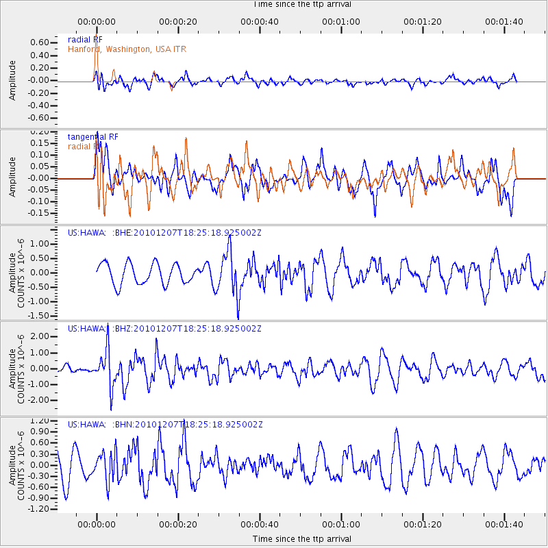
HAWA Hanford, Washington, USA - Earthquake Result Viewer
*The percent match for this event was below the threshold and hence no stack was calculated.
| Earthquake location: |
Komandorskiye Ostrova Region |
| Earthquake latitude/longitude: |
54.4/169.1 |
| Earthquake time(UTC): |
2010/12/07 (341) 18:17:39 GMT |
| Earthquake Depth: |
10 km |
| Earthquake Magnitude: |
6.1 MB, 5.5 MS, 5.8 MW, 5.8 MW |
| Earthquake Catalog/Contributor: |
WHDF/NEIC |
|
| Network: |
US United States National Seismic Network |
| Station: |
HAWA Hanford, Washington, USA |
| Lat/Lon: |
46.39 N/119.53 W |
| Elevation: |
364 m |
|
| Distance: |
44.4 deg |
| Az: |
69.673 deg |
| Baz: |
307.54 deg |
| Ray Param: |
$rayparam |
*The percent match for this event was below the threshold and hence was not used in the summary stack. |
|
| Radial Match: |
46.31889 % |
| Radial Bump: |
400 |
| Transverse Match: |
51.988037 % |
| Transverse Bump: |
400 |
| SOD ConfigId: |
343951 |
| Insert Time: |
2011-05-24 11:13:47.587 +0000 |
| GWidth: |
2.5 |
| Max Bumps: |
400 |
| Tol: |
0.001 |
|
Signal To Noise
| Channel | StoN | STA | LTA |
| US:HAWA: :BHZ:20101207T18:25:18.925002Z | 2.5269349 | 1.1616224E-6 | 4.5969625E-7 |
| US:HAWA: :BHN:20101207T18:25:18.925002Z | 0.91433287 | 3.8977873E-7 | 4.262985E-7 |
| US:HAWA: :BHE:20101207T18:25:18.925002Z | 2.2032576 | 7.6180737E-7 | 3.457641E-7 |
| Arrivals |
| Ps | |
| PpPs | |
| PsPs/PpSs | |


