You are here: Home > Network List > US - United States National Seismic Network Stations List
> Station MNTX Cornudas Mountains, Texas, USA > Earthquake Result Viewer
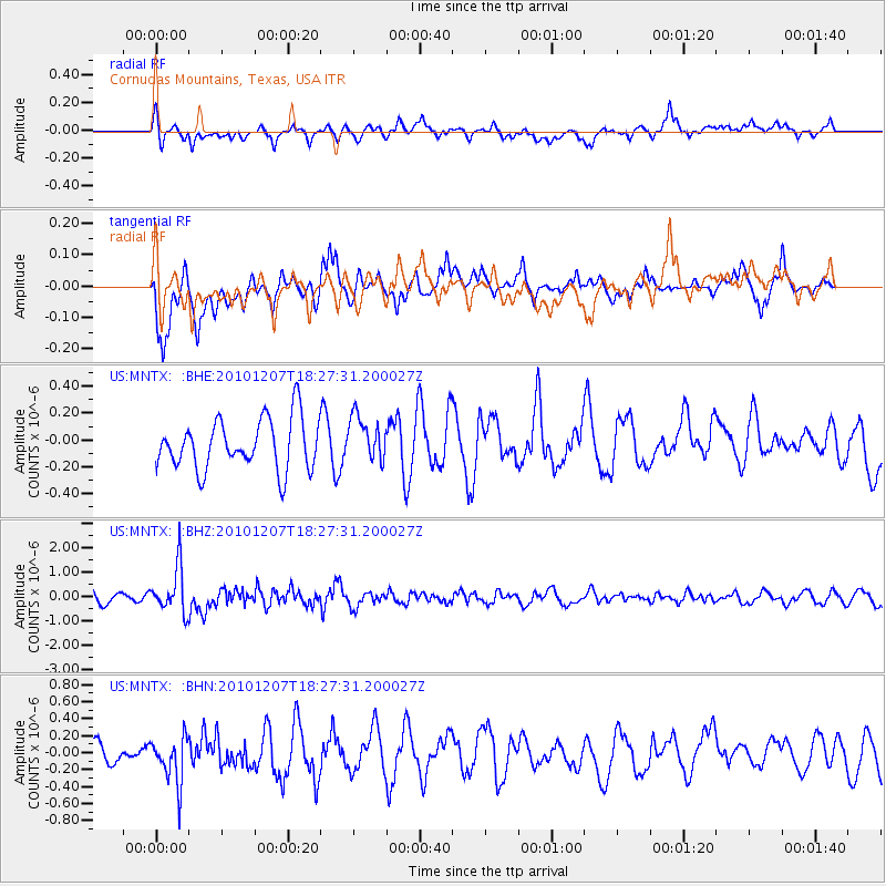
MNTX Cornudas Mountains, Texas, USA - Earthquake Result Viewer
*The percent match for this event was below the threshold and hence no stack was calculated.
| Earthquake location: |
Komandorskiye Ostrova Region |
| Earthquake latitude/longitude: |
54.4/169.1 |
| Earthquake time(UTC): |
2010/12/07 (341) 18:17:39 GMT |
| Earthquake Depth: |
10 km |
| Earthquake Magnitude: |
6.1 MB, 5.5 MS, 5.8 MW, 5.8 MW |
| Earthquake Catalog/Contributor: |
WHDF/NEIC |
|
| Network: |
US United States National Seismic Network |
| Station: |
MNTX Cornudas Mountains, Texas, USA |
| Lat/Lon: |
31.70 N/105.38 W |
| Elevation: |
404 m |
|
| Distance: |
62.4 deg |
| Az: |
73.495 deg |
| Baz: |
318.828 deg |
| Ray Param: |
$rayparam |
*The percent match for this event was below the threshold and hence was not used in the summary stack. |
|
| Radial Match: |
52.41234 % |
| Radial Bump: |
400 |
| Transverse Match: |
51.416603 % |
| Transverse Bump: |
372 |
| SOD ConfigId: |
343951 |
| Insert Time: |
2011-05-24 11:17:25.754 +0000 |
| GWidth: |
2.5 |
| Max Bumps: |
400 |
| Tol: |
0.001 |
|
Signal To Noise
| Channel | StoN | STA | LTA |
| US:MNTX: :BHZ:20101207T18:27:31.200027Z | 3.8169622 | 9.326853E-7 | 2.4435278E-7 |
| US:MNTX: :BHN:20101207T18:27:31.200027Z | 2.169805 | 2.857073E-7 | 1.3167417E-7 |
| US:MNTX: :BHE:20101207T18:27:31.200027Z | 0.9051429 | 1.68623E-7 | 1.8629436E-7 |
| Arrivals |
| Ps | |
| PpPs | |
| PsPs/PpSs | |


