You are here: Home > Network List > US - United States National Seismic Network Stations List
> Station AGMN Agassiz National Wildlife Refuge, Minnesota, USA > Earthquake Result Viewer
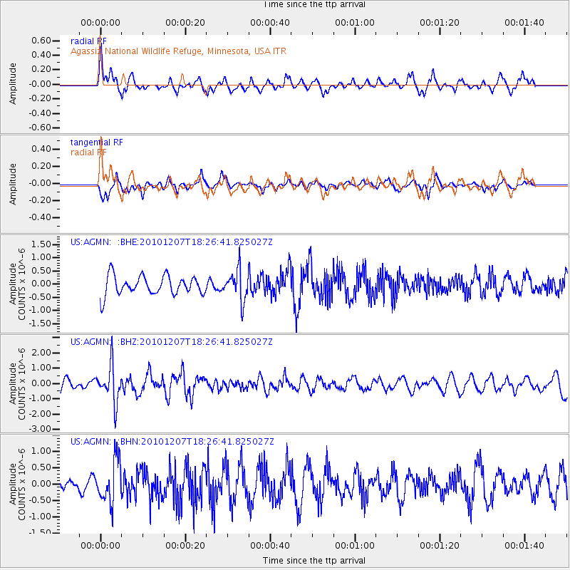
AGMN Agassiz National Wildlife Refuge, Minnesota, USA - Earthquake Result Viewer
*The percent match for this event was below the threshold and hence no stack was calculated.
| Earthquake location: |
Komandorskiye Ostrova Region |
| Earthquake latitude/longitude: |
54.4/169.1 |
| Earthquake time(UTC): |
2010/12/07 (341) 18:17:39 GMT |
| Earthquake Depth: |
10 km |
| Earthquake Magnitude: |
6.1 MB, 5.5 MS, 5.8 MW, 5.8 MW |
| Earthquake Catalog/Contributor: |
WHDF/NEIC |
|
| Network: |
US United States National Seismic Network |
| Station: |
AGMN Agassiz National Wildlife Refuge, Minnesota, USA |
| Lat/Lon: |
48.30 N/95.86 W |
| Elevation: |
351 m |
|
| Distance: |
55.3 deg |
| Az: |
54.015 deg |
| Baz: |
314.829 deg |
| Ray Param: |
$rayparam |
*The percent match for this event was below the threshold and hence was not used in the summary stack. |
|
| Radial Match: |
51.916187 % |
| Radial Bump: |
369 |
| Transverse Match: |
75.44211 % |
| Transverse Bump: |
368 |
| SOD ConfigId: |
343951 |
| Insert Time: |
2011-05-24 11:26:14.009 +0000 |
| GWidth: |
2.5 |
| Max Bumps: |
400 |
| Tol: |
0.001 |
|
Signal To Noise
| Channel | StoN | STA | LTA |
| US:AGMN: :BHZ:20101207T18:26:41.825027Z | 3.4191592 | 1.2129491E-6 | 3.5475068E-7 |
| US:AGMN: :BHN:20101207T18:26:41.825027Z | 2.1510992 | 6.662395E-7 | 3.097205E-7 |
| US:AGMN: :BHE:20101207T18:26:41.825027Z | 1.6573664 | 5.971195E-7 | 3.6028212E-7 |
| Arrivals |
| Ps | |
| PpPs | |
| PsPs/PpSs | |


