You are here: Home > Network List > UW - Pacific Northwest Regional Seismic Network Stations List
> Station MRBL Marblemount, WA, USA > Earthquake Result Viewer
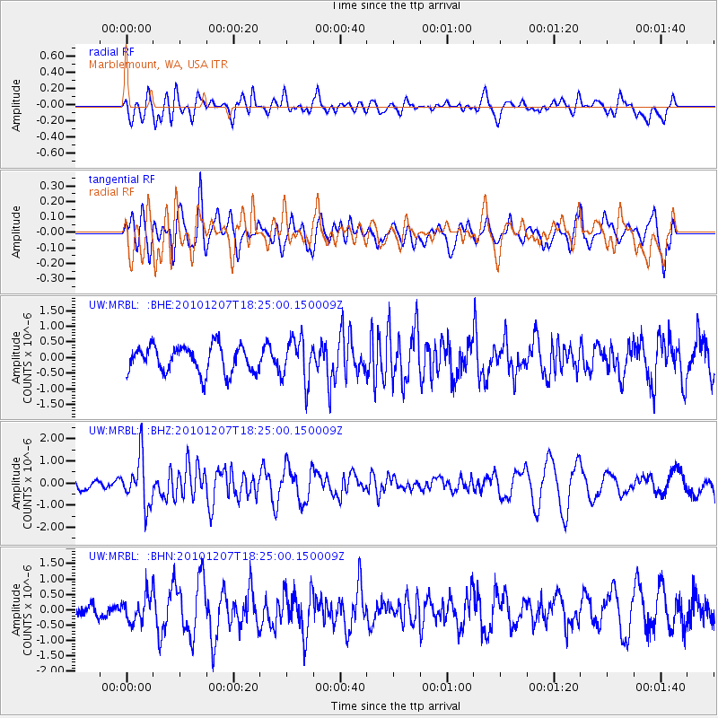
MRBL Marblemount, WA, USA - Earthquake Result Viewer
*The percent match for this event was below the threshold and hence no stack was calculated.
| Earthquake location: |
Komandorskiye Ostrova Region |
| Earthquake latitude/longitude: |
54.4/169.1 |
| Earthquake time(UTC): |
2010/12/07 (341) 18:17:39 GMT |
| Earthquake Depth: |
10 km |
| Earthquake Magnitude: |
6.1 MB, 5.5 MS, 5.8 MW, 5.8 MW |
| Earthquake Catalog/Contributor: |
WHDF/NEIC |
|
| Network: |
UW Pacific Northwest Regional Seismic Network |
| Station: |
MRBL Marblemount, WA, USA |
| Lat/Lon: |
48.52 N/121.48 W |
| Elevation: |
75 m |
|
| Distance: |
42.0 deg |
| Az: |
68.317 deg |
| Baz: |
305.118 deg |
| Ray Param: |
$rayparam |
*The percent match for this event was below the threshold and hence was not used in the summary stack. |
|
| Radial Match: |
61.60229 % |
| Radial Bump: |
400 |
| Transverse Match: |
58.137077 % |
| Transverse Bump: |
400 |
| SOD ConfigId: |
343951 |
| Insert Time: |
2011-05-24 11:27:56.041 +0000 |
| GWidth: |
2.5 |
| Max Bumps: |
400 |
| Tol: |
0.001 |
|
Signal To Noise
| Channel | StoN | STA | LTA |
| UW:MRBL: :BHZ:20101207T18:25:00.150009Z | 3.0688334 | 1.0866041E-6 | 3.5407726E-7 |
| UW:MRBL: :BHN:20101207T18:25:00.150009Z | 1.0136099 | 4.3967196E-7 | 4.337684E-7 |
| UW:MRBL: :BHE:20101207T18:25:00.150009Z | 1.6177138 | 6.9265883E-7 | 4.2817146E-7 |
| Arrivals |
| Ps | |
| PpPs | |
| PsPs/PpSs | |


