You are here: Home > Network List > AZ - ANZA Regional Network Stations List
> Station SMER AZ.SMER > Earthquake Result Viewer
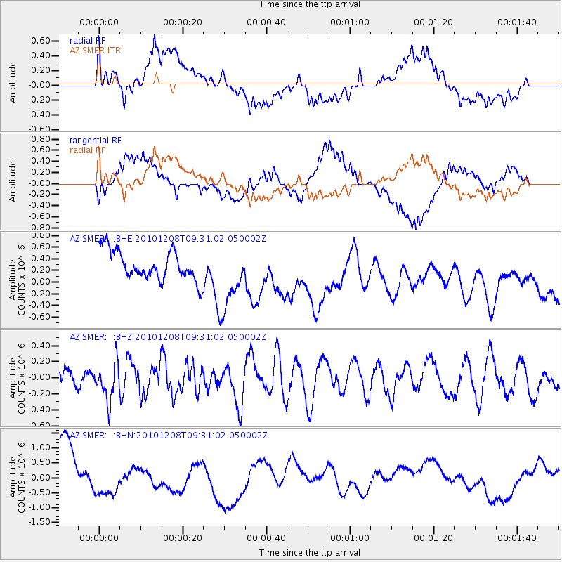
SMER AZ.SMER - Earthquake Result Viewer
*The percent match for this event was below the threshold and hence no stack was calculated.
| Earthquake location: |
South Of Kermadec Islands |
| Earthquake latitude/longitude: |
-32.3/-179.5 |
| Earthquake time(UTC): |
2010/12/08 (342) 09:18:47 GMT |
| Earthquake Depth: |
37 km |
| Earthquake Magnitude: |
5.5 MB, 5.0 MS, 5.4 MW |
| Earthquake Catalog/Contributor: |
WHDF/NEIC |
|
| Network: |
AZ ANZA Regional Network |
| Station: |
SMER AZ.SMER |
| Lat/Lon: |
33.46 N/117.17 W |
| Elevation: |
355 m |
|
| Distance: |
87.9 deg |
| Az: |
47.826 deg |
| Baz: |
228.688 deg |
| Ray Param: |
$rayparam |
*The percent match for this event was below the threshold and hence was not used in the summary stack. |
|
| Radial Match: |
39.855705 % |
| Radial Bump: |
400 |
| Transverse Match: |
38.703747 % |
| Transverse Bump: |
400 |
| SOD ConfigId: |
343951 |
| Insert Time: |
2011-05-24 13:01:19.979 +0000 |
| GWidth: |
2.5 |
| Max Bumps: |
400 |
| Tol: |
0.001 |
|
Signal To Noise
| Channel | StoN | STA | LTA |
| AZ:SMER: :BHZ:20101208T09:31:02.050002Z | 1.2783066 | 2.494356E-7 | 1.951297E-7 |
| AZ:SMER: :BHN:20101208T09:31:02.050002Z | 0.7511347 | 6.0905757E-7 | 8.1085E-7 |
| AZ:SMER: :BHE:20101208T09:31:02.050002Z | 2.2201893 | 5.5514965E-7 | 2.500461E-7 |
| Arrivals |
| Ps | |
| PpPs | |
| PsPs/PpSs | |


