You are here: Home > Network List > IW - Intermountain West Stations List
> Station MOOW Moose Ponds, Wyoming, USA > Earthquake Result Viewer
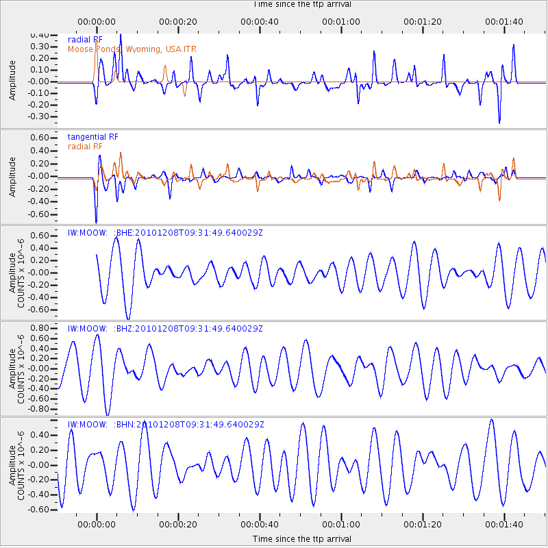
MOOW Moose Ponds, Wyoming, USA - Earthquake Result Viewer
*The percent match for this event was below the threshold and hence no stack was calculated.
| Earthquake location: |
South Of Kermadec Islands |
| Earthquake latitude/longitude: |
-32.3/-179.5 |
| Earthquake time(UTC): |
2010/12/08 (342) 09:18:47 GMT |
| Earthquake Depth: |
37 km |
| Earthquake Magnitude: |
5.5 MB, 5.0 MS, 5.4 MW |
| Earthquake Catalog/Contributor: |
WHDF/NEIC |
|
| Network: |
IW Intermountain West |
| Station: |
MOOW Moose Ponds, Wyoming, USA |
| Lat/Lon: |
43.75 N/110.74 W |
| Elevation: |
2128 m |
|
| Distance: |
98.3 deg |
| Az: |
43.054 deg |
| Baz: |
232.957 deg |
| Ray Param: |
$rayparam |
*The percent match for this event was below the threshold and hence was not used in the summary stack. |
|
| Radial Match: |
70.66193 % |
| Radial Bump: |
393 |
| Transverse Match: |
57.93381 % |
| Transverse Bump: |
400 |
| SOD ConfigId: |
343951 |
| Insert Time: |
2011-05-24 13:11:15.206 +0000 |
| GWidth: |
2.5 |
| Max Bumps: |
400 |
| Tol: |
0.001 |
|
Signal To Noise
| Channel | StoN | STA | LTA |
| IW:MOOW: :BHZ:20101208T09:31:49.640029Z | 2.3815439 | 5.707112E-7 | 2.3963918E-7 |
| IW:MOOW: :BHN:20101208T09:31:49.640029Z | 0.7721782 | 2.1172036E-7 | 2.741859E-7 |
| IW:MOOW: :BHE:20101208T09:31:49.640029Z | 0.36878183 | 1.0915724E-7 | 2.9599408E-7 |
| Arrivals |
| Ps | |
| PpPs | |
| PsPs/PpSs | |


