You are here: Home > Network List > UW - Pacific Northwest Regional Seismic Network Stations List
> Station PASS Maple Falls, WA, USA > Earthquake Result Viewer
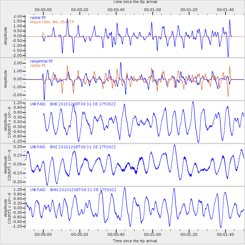
PASS Maple Falls, WA, USA - Earthquake Result Viewer
*The percent match for this event was below the threshold and hence no stack was calculated.
| Earthquake location: |
South Of Kermadec Islands |
| Earthquake latitude/longitude: |
-32.3/-179.5 |
| Earthquake time(UTC): |
2010/12/08 (342) 09:18:47 GMT |
| Earthquake Depth: |
37 km |
| Earthquake Magnitude: |
5.5 MB, 5.0 MS, 5.4 MW |
| Earthquake Catalog/Contributor: |
WHDF/NEIC |
|
| Network: |
UW Pacific Northwest Regional Seismic Network |
| Station: |
PASS Maple Falls, WA, USA |
| Lat/Lon: |
49.00 N/122.09 W |
| Elevation: |
174 m |
|
| Distance: |
95.7 deg |
| Az: |
33.91 deg |
| Baz: |
225.868 deg |
| Ray Param: |
$rayparam |
*The percent match for this event was below the threshold and hence was not used in the summary stack. |
|
| Radial Match: |
50.493412 % |
| Radial Bump: |
400 |
| Transverse Match: |
45.188408 % |
| Transverse Bump: |
398 |
| SOD ConfigId: |
343951 |
| Insert Time: |
2011-05-24 13:21:11.296 +0000 |
| GWidth: |
2.5 |
| Max Bumps: |
400 |
| Tol: |
0.001 |
|
Signal To Noise
| Channel | StoN | STA | LTA |
| UW:PASS: :BHZ:20101208T09:31:38.175002Z | 1.5653588 | 1.9638193E-7 | 1.254549E-7 |
| UW:PASS: :BHN:20101208T09:31:38.175002Z | 0.42253652 | 2.5579823E-7 | 6.0538724E-7 |
| UW:PASS: :BHE:20101208T09:31:38.175002Z | 0.52530235 | 2.888601E-7 | 5.49893E-7 |
| Arrivals |
| Ps | |
| PpPs | |
| PsPs/PpSs | |


