You are here: Home > Network List > IC - New China Digital Seismograph Network Stations List
> Station LSA Tibet, China > Earthquake Result Viewer
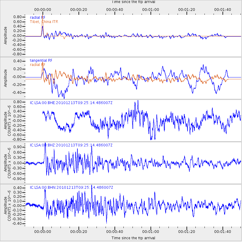
LSA Tibet, China - Earthquake Result Viewer
*The percent match for this event was below the threshold and hence no stack was calculated.
| Earthquake location: |
Sunda Strait, Indonesia |
| Earthquake latitude/longitude: |
-6.3/104.0 |
| Earthquake time(UTC): |
2010/12/13 (347) 09:18:32 GMT |
| Earthquake Depth: |
43 km |
| Earthquake Magnitude: |
5.7 MB, 5.4 MS, 5.7 MW, 5.6 MW |
| Earthquake Catalog/Contributor: |
WHDF/NEIC |
|
| Network: |
IC New China Digital Seismograph Network |
| Station: |
LSA Tibet, China |
| Lat/Lon: |
29.70 N/91.13 E |
| Elevation: |
3660 m |
|
| Distance: |
37.8 deg |
| Az: |
341.568 deg |
| Baz: |
158.821 deg |
| Ray Param: |
$rayparam |
*The percent match for this event was below the threshold and hence was not used in the summary stack. |
|
| Radial Match: |
68.83534 % |
| Radial Bump: |
400 |
| Transverse Match: |
59.23537 % |
| Transverse Bump: |
400 |
| SOD ConfigId: |
343951 |
| Insert Time: |
2011-05-24 14:33:33.811 +0000 |
| GWidth: |
2.5 |
| Max Bumps: |
400 |
| Tol: |
0.001 |
|
Signal To Noise
| Channel | StoN | STA | LTA |
| IC:LSA:00:BHZ:20101213T09:25:14.486007Z | 9.456991 | 4.5113387E-7 | 4.770374E-8 |
| IC:LSA:00:BHN:20101213T09:25:14.486007Z | 4.722195 | 1.5652618E-7 | 3.3146915E-8 |
| IC:LSA:00:BHE:20101213T09:25:14.486007Z | 1.0761571 | 2.9199919E-7 | 2.713351E-7 |
| Arrivals |
| Ps | |
| PpPs | |
| PsPs/PpSs | |


