FRD AZ.FRD - Earthquake Result Viewer
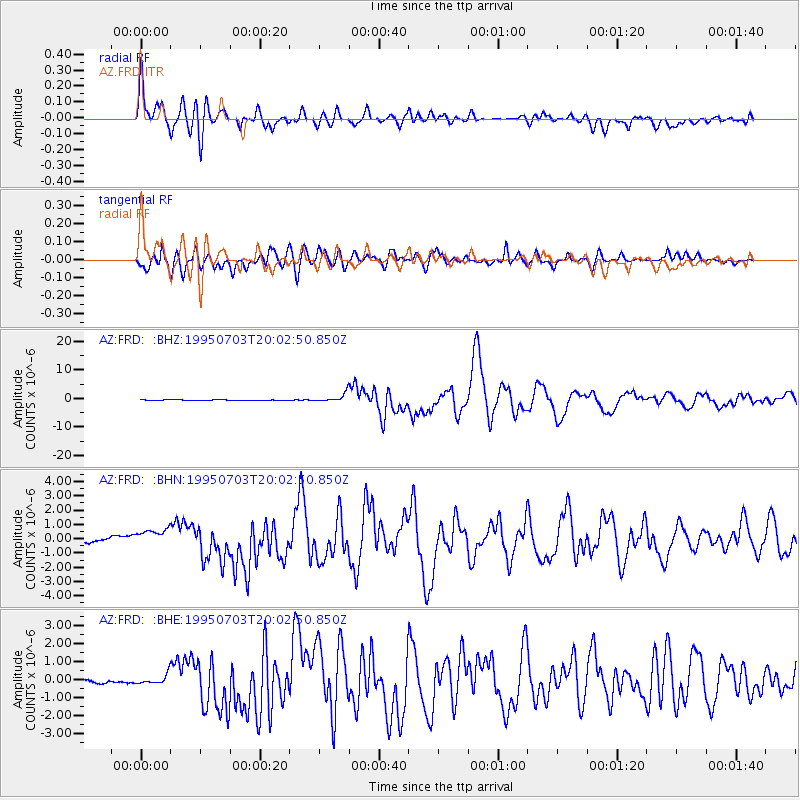
Earthquake location: Kermadec Islands, New Zealand
Earthquake latitude/longitude: -29.2/-177.6
Earthquake time(UTC): 1995/07/03 (184) 19:50:50 GMT
Earthquake Depth: 33 km
Earthquake Magnitude: 6.5 MB, 7.2 MS, 7.2 UNKNOWN, 7.2 MW
Earthquake Catalog/Contributor: WHDF/NEIC
Network: AZ ANZA Regional Network
Station: FRD AZ.FRD
Lat/Lon: 33.49 N/116.60 W
Elevation: 1164 m
Distance: 85.0 deg
Az: 47.202 deg
Baz: 230.15 deg
Ray Param: 0.045050494
Estimated Moho Depth: 15.25 km
Estimated Crust Vp/Vs: 2.10
Assumed Crust Vp: 6.264 km/s
Estimated Crust Vs: 2.986 km/s
Estimated Crust Poisson's Ratio: 0.35
Radial Match: 94.523705 %
Radial Bump: 400
Transverse Match: 92.70656 %
Transverse Bump: 400
SOD ConfigId: 6273
Insert Time: 2010-02-26 19:13:44.497 +0000
GWidth: 2.5
Max Bumps: 400
Tol: 0.001

Signal To Noise

ChannelStoNSTALTA
AZ:FRD: :BHN:19950703T20:02:50.850Z4.62584926.628728E-71.4329754E-7
AZ:FRD: :BHE:19950703T20:02:50.850Z2.28308772.6138483E-71.1448742E-7
AZ:FRD: :BHZ:19950703T20:02:50.850Z15.9061481.5516644E-69.755123E-8
Arrivals
Ps2.7 SECOND
PpPs7.4 SECOND
PsPs/PpSs10 SECOND