You are here: Home > Network List > TA - USArray Transportable Network (new EarthScope stations) Stations List
> Station K31A O'Neill, NE, USA > Earthquake Result Viewer
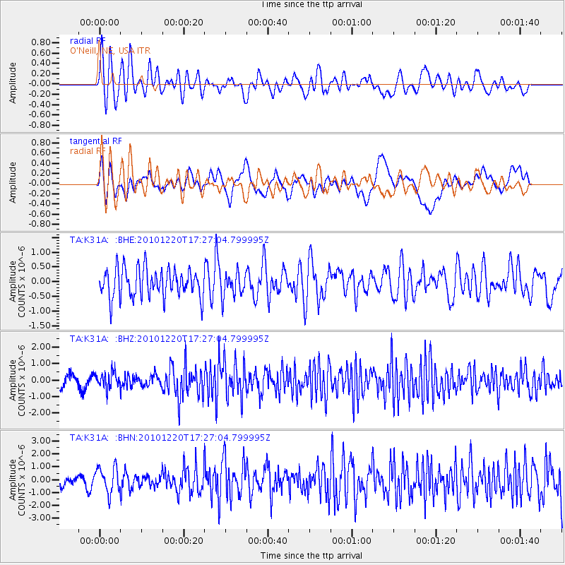
K31A O'Neill, NE, USA - Earthquake Result Viewer
*The percent match for this event was below the threshold and hence no stack was calculated.
| Earthquake location: |
Off Coast Of Central America |
| Earthquake latitude/longitude: |
13.0/-88.6 |
| Earthquake time(UTC): |
2010/12/20 (354) 17:21:26 GMT |
| Earthquake Depth: |
72 km |
| Earthquake Magnitude: |
5.5 MB, 5.7 MW, 5.7 MW |
| Earthquake Catalog/Contributor: |
WHDF/NEIC |
|
| Network: |
TA USArray Transportable Network (new EarthScope stations) |
| Station: |
K31A O'Neill, NE, USA |
| Lat/Lon: |
42.62 N/98.75 W |
| Elevation: |
580 m |
|
| Distance: |
30.8 deg |
| Az: |
345.334 deg |
| Baz: |
160.467 deg |
| Ray Param: |
$rayparam |
*The percent match for this event was below the threshold and hence was not used in the summary stack. |
|
| Radial Match: |
70.897644 % |
| Radial Bump: |
400 |
| Transverse Match: |
52.929977 % |
| Transverse Bump: |
400 |
| SOD ConfigId: |
343951 |
| Insert Time: |
2011-05-24 16:04:44.627 +0000 |
| GWidth: |
2.5 |
| Max Bumps: |
400 |
| Tol: |
0.001 |
|
Signal To Noise
| Channel | StoN | STA | LTA |
| TA:K31A: :BHZ:20101220T17:27:04.799995Z | 1.4016122 | 4.7255676E-7 | 3.371523E-7 |
| TA:K31A: :BHN:20101220T17:27:04.799995Z | 2.195349 | 1.0130539E-6 | 4.614546E-7 |
| TA:K31A: :BHE:20101220T17:27:04.799995Z | 0.83782136 | 4.0516892E-7 | 4.835982E-7 |
| Arrivals |
| Ps | |
| PpPs | |
| PsPs/PpSs | |


