You are here: Home > Network List > TA - USArray Transportable Network (new EarthScope stations) Stations List
> Station E36A McGregor, MN, USA > Earthquake Result Viewer
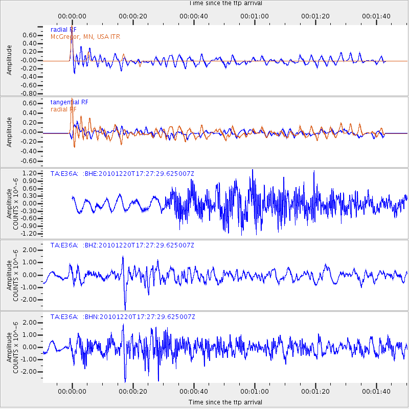
E36A McGregor, MN, USA - Earthquake Result Viewer
*The percent match for this event was below the threshold and hence no stack was calculated.
| Earthquake location: |
Off Coast Of Central America |
| Earthquake latitude/longitude: |
13.0/-88.6 |
| Earthquake time(UTC): |
2010/12/20 (354) 17:21:26 GMT |
| Earthquake Depth: |
72 km |
| Earthquake Magnitude: |
5.5 MB, 5.7 MW, 5.7 MW |
| Earthquake Catalog/Contributor: |
WHDF/NEIC |
|
| Network: |
TA USArray Transportable Network (new EarthScope stations) |
| Station: |
E36A McGregor, MN, USA |
| Lat/Lon: |
46.52 N/93.26 W |
| Elevation: |
393 m |
|
| Distance: |
33.6 deg |
| Az: |
354.243 deg |
| Baz: |
171.86 deg |
| Ray Param: |
$rayparam |
*The percent match for this event was below the threshold and hence was not used in the summary stack. |
|
| Radial Match: |
64.06926 % |
| Radial Bump: |
400 |
| Transverse Match: |
66.60349 % |
| Transverse Bump: |
400 |
| SOD ConfigId: |
343951 |
| Insert Time: |
2011-05-24 16:17:09.059 +0000 |
| GWidth: |
2.5 |
| Max Bumps: |
400 |
| Tol: |
0.001 |
|
Signal To Noise
| Channel | StoN | STA | LTA |
| TA:E36A: :BHZ:20101220T17:27:29.625007Z | 1.447533 | 5.11736E-7 | 3.5352286E-7 |
| TA:E36A: :BHN:20101220T17:27:29.625007Z | 3.0007722 | 7.2846876E-7 | 2.4276042E-7 |
| TA:E36A: :BHE:20101220T17:27:29.625007Z | 1.6375309 | 3.0177176E-7 | 1.8428462E-7 |
| Arrivals |
| Ps | |
| PpPs | |
| PsPs/PpSs | |


