You are here: Home > Network List > US - United States National Seismic Network Stations List
> Station ERPA Erie, Pennsylvania, USA > Earthquake Result Viewer
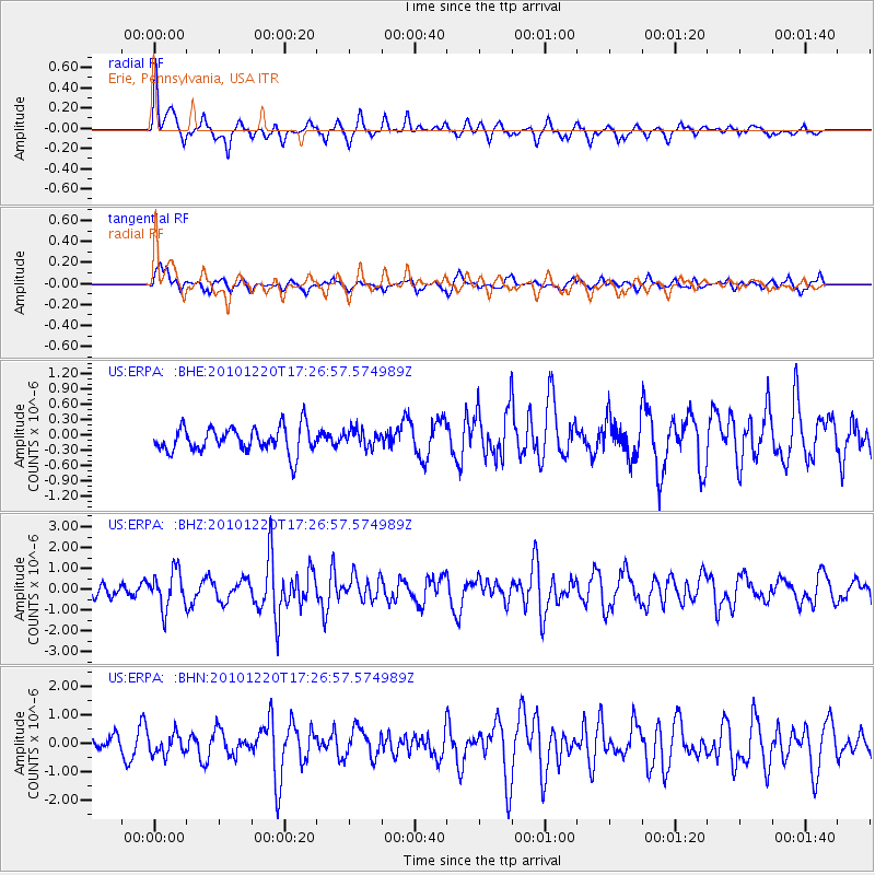
ERPA Erie, Pennsylvania, USA - Earthquake Result Viewer
*The percent match for this event was below the threshold and hence no stack was calculated.
| Earthquake location: |
Off Coast Of Central America |
| Earthquake latitude/longitude: |
13.0/-88.6 |
| Earthquake time(UTC): |
2010/12/20 (354) 17:21:26 GMT |
| Earthquake Depth: |
72 km |
| Earthquake Magnitude: |
5.5 MB, 5.7 MW, 5.7 MW |
| Earthquake Catalog/Contributor: |
WHDF/NEIC |
|
| Network: |
US United States National Seismic Network |
| Station: |
ERPA Erie, Pennsylvania, USA |
| Lat/Lon: |
42.12 N/79.99 W |
| Elevation: |
306 m |
|
| Distance: |
30.0 deg |
| Az: |
12.943 deg |
| Baz: |
197.064 deg |
| Ray Param: |
$rayparam |
*The percent match for this event was below the threshold and hence was not used in the summary stack. |
|
| Radial Match: |
62.644867 % |
| Radial Bump: |
372 |
| Transverse Match: |
59.18927 % |
| Transverse Bump: |
400 |
| SOD ConfigId: |
343951 |
| Insert Time: |
2011-05-24 16:19:24.785 +0000 |
| GWidth: |
2.5 |
| Max Bumps: |
400 |
| Tol: |
0.001 |
|
Signal To Noise
| Channel | StoN | STA | LTA |
| US:ERPA: :BHZ:20101220T17:26:57.574989Z | 2.9287019 | 9.057311E-7 | 3.0926026E-7 |
| US:ERPA: :BHN:20101220T17:26:57.574989Z | 0.681854 | 3.507753E-7 | 5.144434E-7 |
| US:ERPA: :BHE:20101220T17:26:57.574989Z | 0.67096853 | 1.6743921E-7 | 2.4954855E-7 |
| Arrivals |
| Ps | |
| PpPs | |
| PsPs/PpSs | |


