You are here: Home > Network List > CI - Caltech Regional Seismic Network Stations List
> Station SMM Simmler, CA, USA > Earthquake Result Viewer
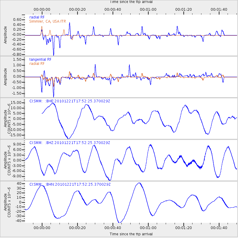
SMM Simmler, CA, USA - Earthquake Result Viewer
*The percent match for this event was below the threshold and hence no stack was calculated.
| Earthquake location: |
Bonin Islands, Japan Region |
| Earthquake latitude/longitude: |
27.1/143.2 |
| Earthquake time(UTC): |
2010/12/21 (355) 17:40:47 GMT |
| Earthquake Depth: |
10 km |
| Earthquake Magnitude: |
5.5 MB |
| Earthquake Catalog/Contributor: |
WHDF/NEIC |
|
| Network: |
CI Caltech Regional Seismic Network |
| Station: |
SMM Simmler, CA, USA |
| Lat/Lon: |
35.31 N/120.00 W |
| Elevation: |
599 m |
|
| Distance: |
80.0 deg |
| Az: |
55.56 deg |
| Baz: |
295.956 deg |
| Ray Param: |
$rayparam |
*The percent match for this event was below the threshold and hence was not used in the summary stack. |
|
| Radial Match: |
65.309586 % |
| Radial Bump: |
240 |
| Transverse Match: |
63.131203 % |
| Transverse Bump: |
400 |
| SOD ConfigId: |
343951 |
| Insert Time: |
2011-05-24 17:17:56.208 +0000 |
| GWidth: |
2.5 |
| Max Bumps: |
400 |
| Tol: |
0.001 |
|
Signal To Noise
| Channel | StoN | STA | LTA |
| CI:SMM: :BHZ:20101221T17:52:25.370029Z | 1.1939088 | 5.067225E-6 | 4.244231E-6 |
| CI:SMM: :BHN:20101221T17:52:25.370029Z | 3.583375 | 2.906933E-5 | 8.112277E-6 |
| CI:SMM: :BHE:20101221T17:52:25.370029Z | 0.149972 | 1.6495134E-6 | 1.0998809E-5 |
| Arrivals |
| Ps | |
| PpPs | |
| PsPs/PpSs | |


