You are here: Home > Network List > TA - USArray Transportable Network (new EarthScope stations) Stations List
> Station X31A McDonald Ranch, Hollis, OK, USA > Earthquake Result Viewer
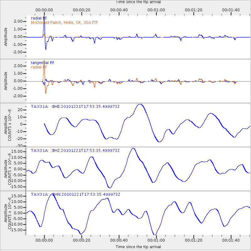
X31A McDonald Ranch, Hollis, OK, USA - Earthquake Result Viewer
*The percent match for this event was below the threshold and hence no stack was calculated.
| Earthquake location: |
Bonin Islands, Japan Region |
| Earthquake latitude/longitude: |
27.1/143.2 |
| Earthquake time(UTC): |
2010/12/21 (355) 17:40:47 GMT |
| Earthquake Depth: |
10 km |
| Earthquake Magnitude: |
5.5 MB |
| Earthquake Catalog/Contributor: |
WHDF/NEIC |
|
| Network: |
TA USArray Transportable Network (new EarthScope stations) |
| Station: |
X31A McDonald Ranch, Hollis, OK, USA |
| Lat/Lon: |
34.63 N/99.98 W |
| Elevation: |
514 m |
|
| Distance: |
94.3 deg |
| Az: |
47.57 deg |
| Baz: |
307.054 deg |
| Ray Param: |
$rayparam |
*The percent match for this event was below the threshold and hence was not used in the summary stack. |
|
| Radial Match: |
32.223648 % |
| Radial Bump: |
400 |
| Transverse Match: |
56.8372 % |
| Transverse Bump: |
400 |
| SOD ConfigId: |
343951 |
| Insert Time: |
2011-05-24 17:32:14.852 +0000 |
| GWidth: |
2.5 |
| Max Bumps: |
400 |
| Tol: |
0.001 |
|
Signal To Noise
| Channel | StoN | STA | LTA |
| TA:X31A: :BHZ:20101221T17:53:35.499973Z | 1.6868924 | 6.993578E-6 | 4.145835E-6 |
| TA:X31A: :BHN:20101221T17:53:35.499973Z | 6.034456 | 1.2392486E-5 | 2.053621E-6 |
| TA:X31A: :BHE:20101221T17:53:35.499973Z | 2.0815878 | 1.5546926E-5 | 7.4687823E-6 |
| Arrivals |
| Ps | |
| PpPs | |
| PsPs/PpSs | |


