You are here: Home > Network List > TA - USArray Transportable Network (new EarthScope stations) Stations List
> Station S31A Mullinville, KS, USA > Earthquake Result Viewer
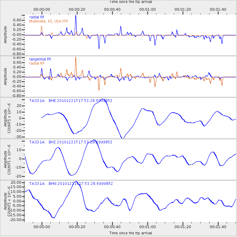
S31A Mullinville, KS, USA - Earthquake Result Viewer
*The percent match for this event was below the threshold and hence no stack was calculated.
| Earthquake location: |
Bonin Islands, Japan Region |
| Earthquake latitude/longitude: |
27.1/143.2 |
| Earthquake time(UTC): |
2010/12/21 (355) 17:40:47 GMT |
| Earthquake Depth: |
10 km |
| Earthquake Magnitude: |
5.5 MB |
| Earthquake Catalog/Contributor: |
WHDF/NEIC |
|
| Network: |
TA USArray Transportable Network (new EarthScope stations) |
| Station: |
S31A Mullinville, KS, USA |
| Lat/Lon: |
37.62 N/99.48 W |
| Elevation: |
700 m |
|
| Distance: |
92.8 deg |
| Az: |
44.949 deg |
| Baz: |
307.508 deg |
| Ray Param: |
$rayparam |
*The percent match for this event was below the threshold and hence was not used in the summary stack. |
|
| Radial Match: |
71.99903 % |
| Radial Bump: |
281 |
| Transverse Match: |
75.12132 % |
| Transverse Bump: |
400 |
| SOD ConfigId: |
343951 |
| Insert Time: |
2011-05-24 17:35:10.938 +0000 |
| GWidth: |
2.5 |
| Max Bumps: |
400 |
| Tol: |
0.001 |
|
Signal To Noise
| Channel | StoN | STA | LTA |
| TA:S31A: :BHZ:20101221T17:53:28.699985Z | 0.23767109 | 3.0173187E-6 | 1.2695355E-5 |
| TA:S31A: :BHN:20101221T17:53:28.699985Z | 2.029413 | 1.0409159E-5 | 5.1291477E-6 |
| TA:S31A: :BHE:20101221T17:53:28.699985Z | 2.4414134 | 3.0813306E-5 | 1.26210925E-5 |
| Arrivals |
| Ps | |
| PpPs | |
| PsPs/PpSs | |


