You are here: Home > Network List > TA - USArray Transportable Network (new EarthScope stations) Stations List
> Station Q30A Quinter, KS, USA > Earthquake Result Viewer
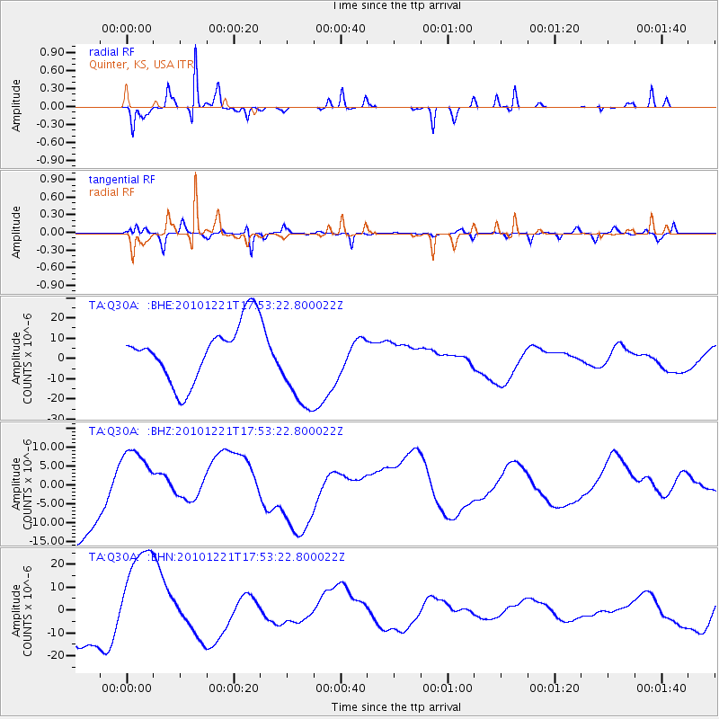
Q30A Quinter, KS, USA - Earthquake Result Viewer
*The percent match for this event was below the threshold and hence no stack was calculated.
| Earthquake location: |
Bonin Islands, Japan Region |
| Earthquake latitude/longitude: |
27.1/143.2 |
| Earthquake time(UTC): |
2010/12/21 (355) 17:40:47 GMT |
| Earthquake Depth: |
10 km |
| Earthquake Magnitude: |
5.5 MB |
| Earthquake Catalog/Contributor: |
WHDF/NEIC |
|
| Network: |
TA USArray Transportable Network (new EarthScope stations) |
| Station: |
Q30A Quinter, KS, USA |
| Lat/Lon: |
38.98 N/100.22 W |
| Elevation: |
797 m |
|
| Distance: |
91.6 deg |
| Az: |
44.221 deg |
| Baz: |
307.082 deg |
| Ray Param: |
$rayparam |
*The percent match for this event was below the threshold and hence was not used in the summary stack. |
|
| Radial Match: |
78.34386 % |
| Radial Bump: |
158 |
| Transverse Match: |
74.87752 % |
| Transverse Bump: |
315 |
| SOD ConfigId: |
343951 |
| Insert Time: |
2011-05-24 17:36:13.625 +0000 |
| GWidth: |
2.5 |
| Max Bumps: |
400 |
| Tol: |
0.001 |
|
Signal To Noise
| Channel | StoN | STA | LTA |
| TA:Q30A: :BHZ:20101221T17:53:22.800022Z | 0.74073386 | 8.974519E-6 | 1.2115714E-5 |
| TA:Q30A: :BHN:20101221T17:53:22.800022Z | 2.7990985 | 2.3514724E-5 | 8.400821E-6 |
| TA:Q30A: :BHE:20101221T17:53:22.800022Z | 1.6232567 | 2.2579952E-5 | 1.3910278E-5 |
| Arrivals |
| Ps | |
| PpPs | |
| PsPs/PpSs | |


